Photograph as originally submitted to
this page in the Historical Marker Database
www.HMdb.org.
Click on photo to resize in browser. Scroll down to see metadata.
Photographer: Don Morfe
Taken: November 6, 2008
Caption:
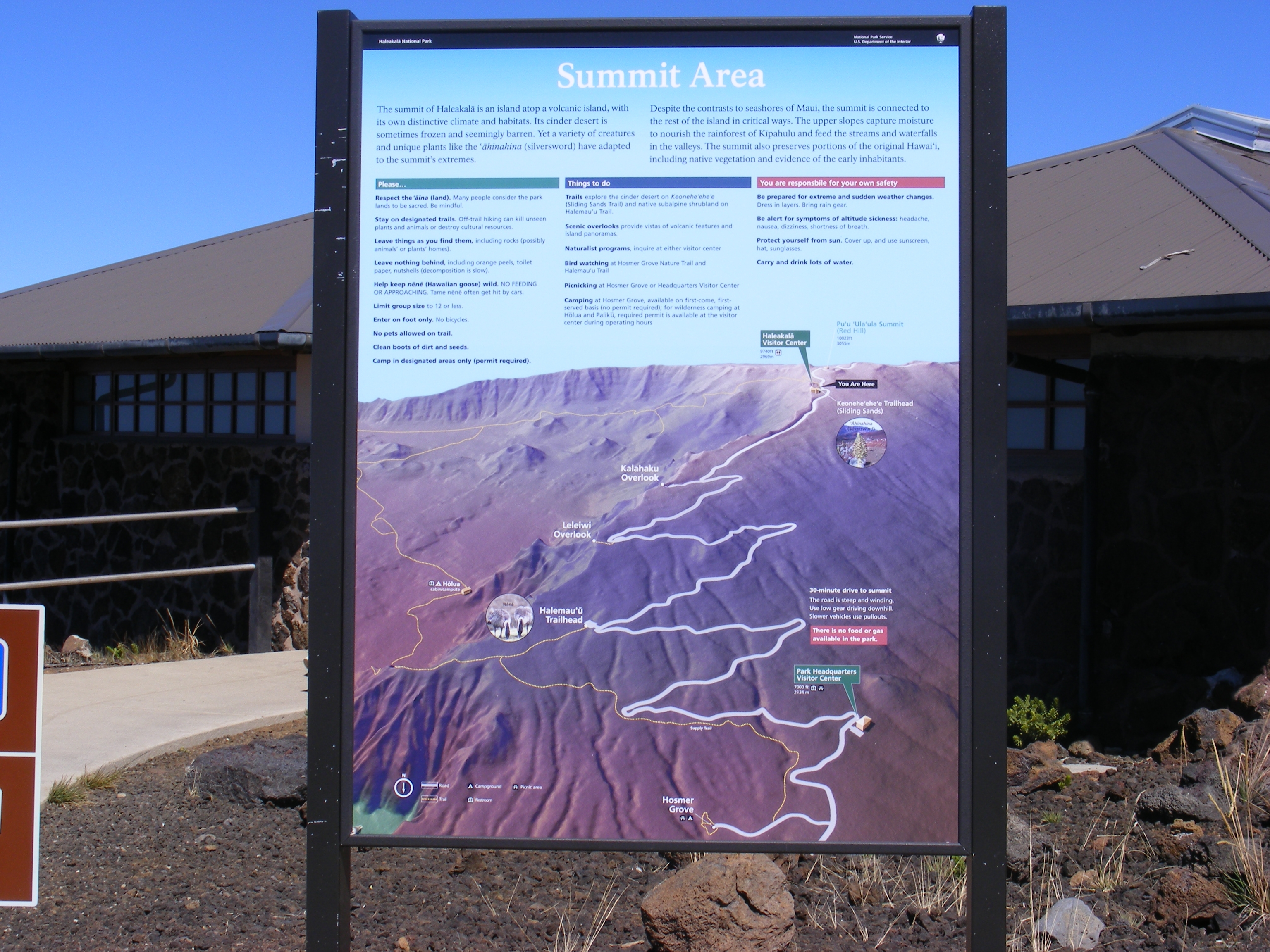
Haleakala National Park Marker-Summit Area | Additional Description: The summit of Halaekala is an island atop a volcanic island, with its own distinctive climate and habitats. Its cinder desert is sometimes frozen and seemingly barren. Yet a variety of creatures and unique plants like the ahinahina (silversword) have adapted to the summit’s extremes. Despite the contracts to seashores of Maui, the summit is connected to the rest of the island in critical ways. The upper slopes capture moisture to nourish the rainforest of Kipahulu and feed the streams and waterfalls in the valleys. The summit also preserves portions of the original Hawai’i including native vegetation and evidence of the early inhabitants.
Submitted: February 14, 2014, by Don Morfe of Baltimore, Maryland.
Database Locator Identification Number: p266336
File Size: 2.790 Megabytes
To see the metadata that may be embedded in this photo, sign in and then return to this page.