Photograph as originally submitted to
this page in the Historical Marker Database
www.HMdb.org.
Click on photo to resize in browser. Scroll down to see metadata.
Photographer: Courtesy Wikipedia Commons
Taken: 1873
Caption:
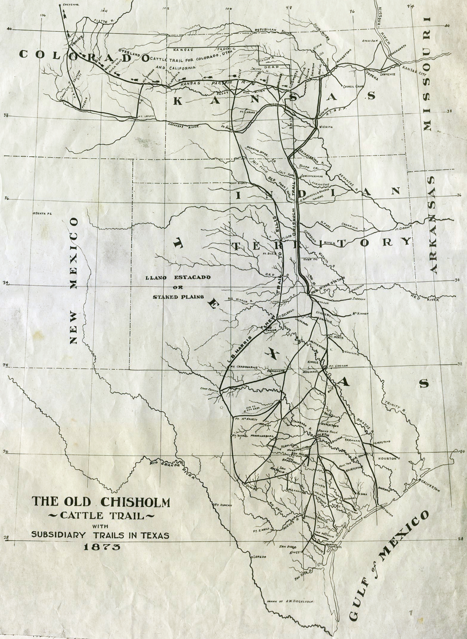
Map of the Old Chisholm Cattle Trail | Additional Description: Original in the collection of the Kansas Historical Society. Click on map to zoom in.
Submitted: March 1, 2014.
Database Locator Identification Number: p267376
File Size: 2.528 Megabytes
To see the metadata that may be embedded in this photo, sign in and then return to this page.