Photograph as originally submitted to
this page in the Historical Marker Database
www.HMdb.org.
Click on photo to resize in browser. Scroll down to see metadata.
Photographer: Cosmos Mariner
Taken: June 14, 2013
Caption:
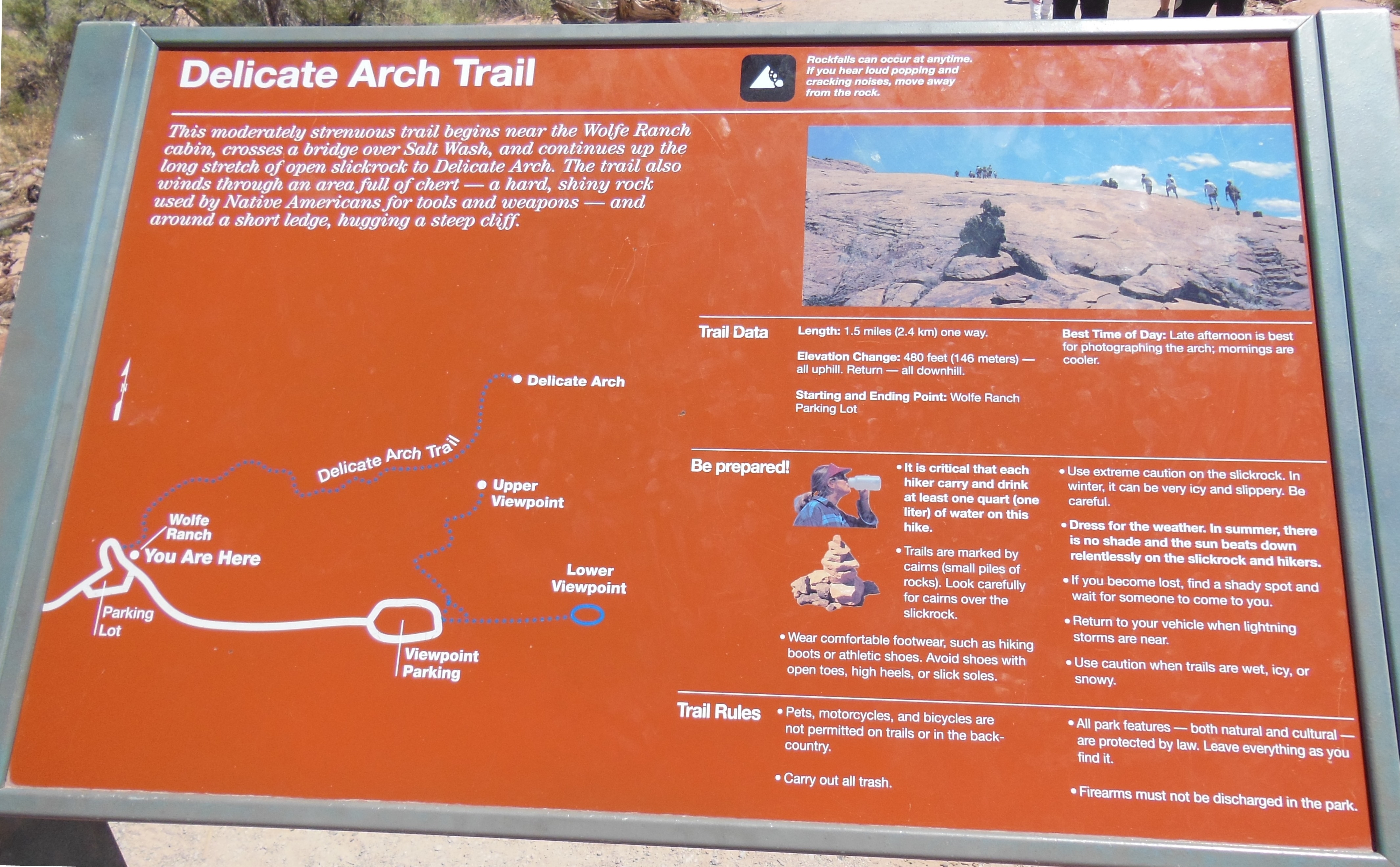
Delicate Arch Trail Map | Additional Description: This moderately strenuous trail begins near the Wolfe Ranch cabin, crosses a bridge over Salt Wash, and continues up the long stretch of open slickrock to Delicate Arch. The trail also winds through an area full of chert – a hard, shiny rock used by Native Americans for tools and weapons – and around a short ledge, hugging a steep cliff.
Submitted: April 1, 2014, by Cosmos Mariner of Cape Canaveral, Florida.
Database Locator Identification Number: p269781
File Size: 1.983 Megabytes
To see the metadata that may be embedded in this photo, sign in and then return to this page.