Photograph as originally submitted to
this page in the Historical Marker Database
www.HMdb.org.
Click on photo to resize in browser. Scroll down to see metadata.
Photographer: K. Linzmeier
Taken: May 5, 2014
Caption:
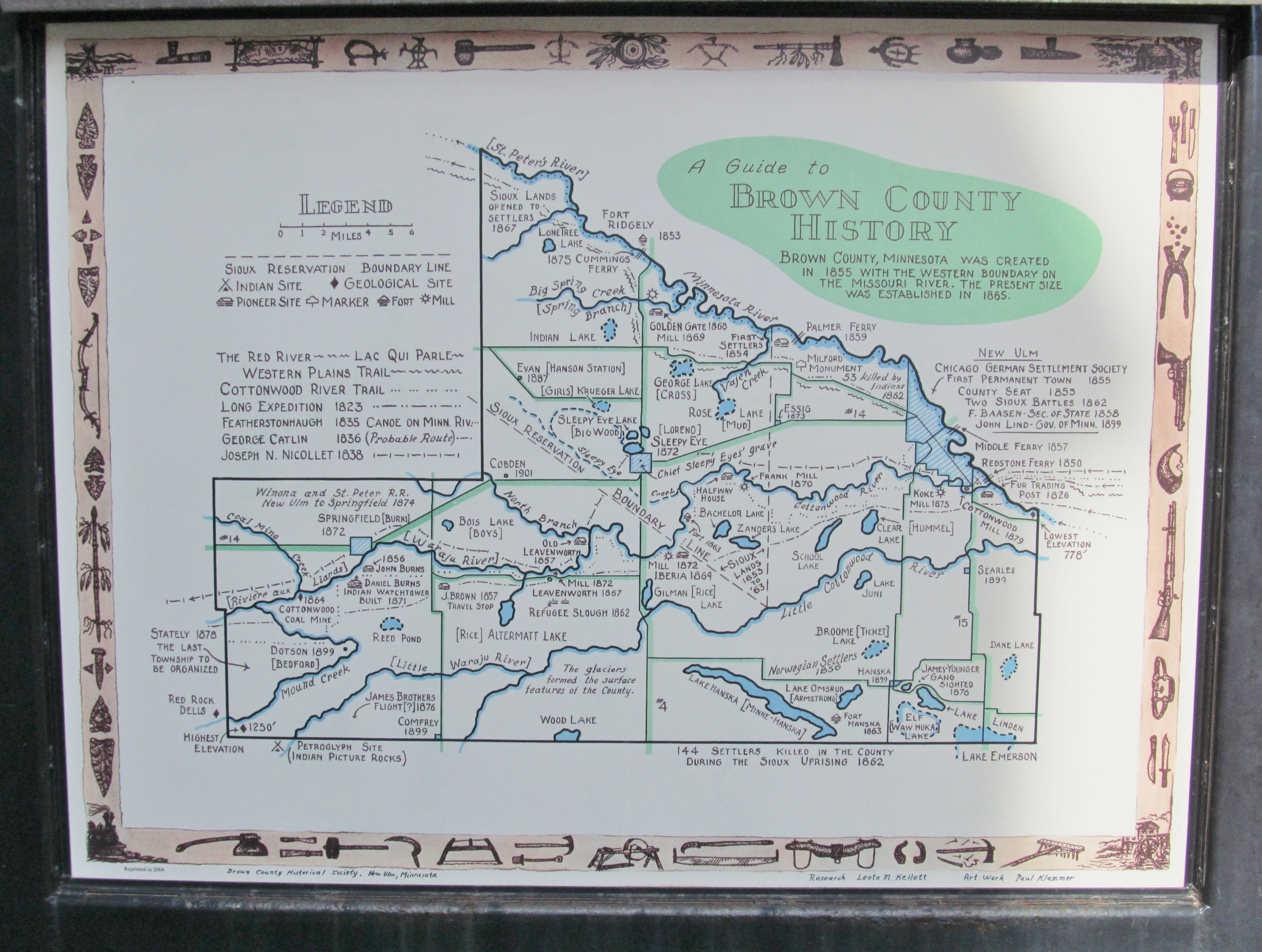
Nearby Brown County History Map | Additional Description: Paul Klammer map based on the research done by Leota Kellet.
Submitted: May 29, 2014, by Keith L of Wisconsin Rapids, Wisconsin.
Database Locator Identification Number: p274559
File Size: 7.479 Megabytes
To see the metadata that may be embedded in this photo, sign in and then return to this page.