Photograph as originally submitted to
this page in the Historical Marker Database
www.HMdb.org.
Click on photo to resize in browser. Scroll down to see metadata.
Photographer: Barry Swackhamer
Taken: May 26, 2014
Caption:
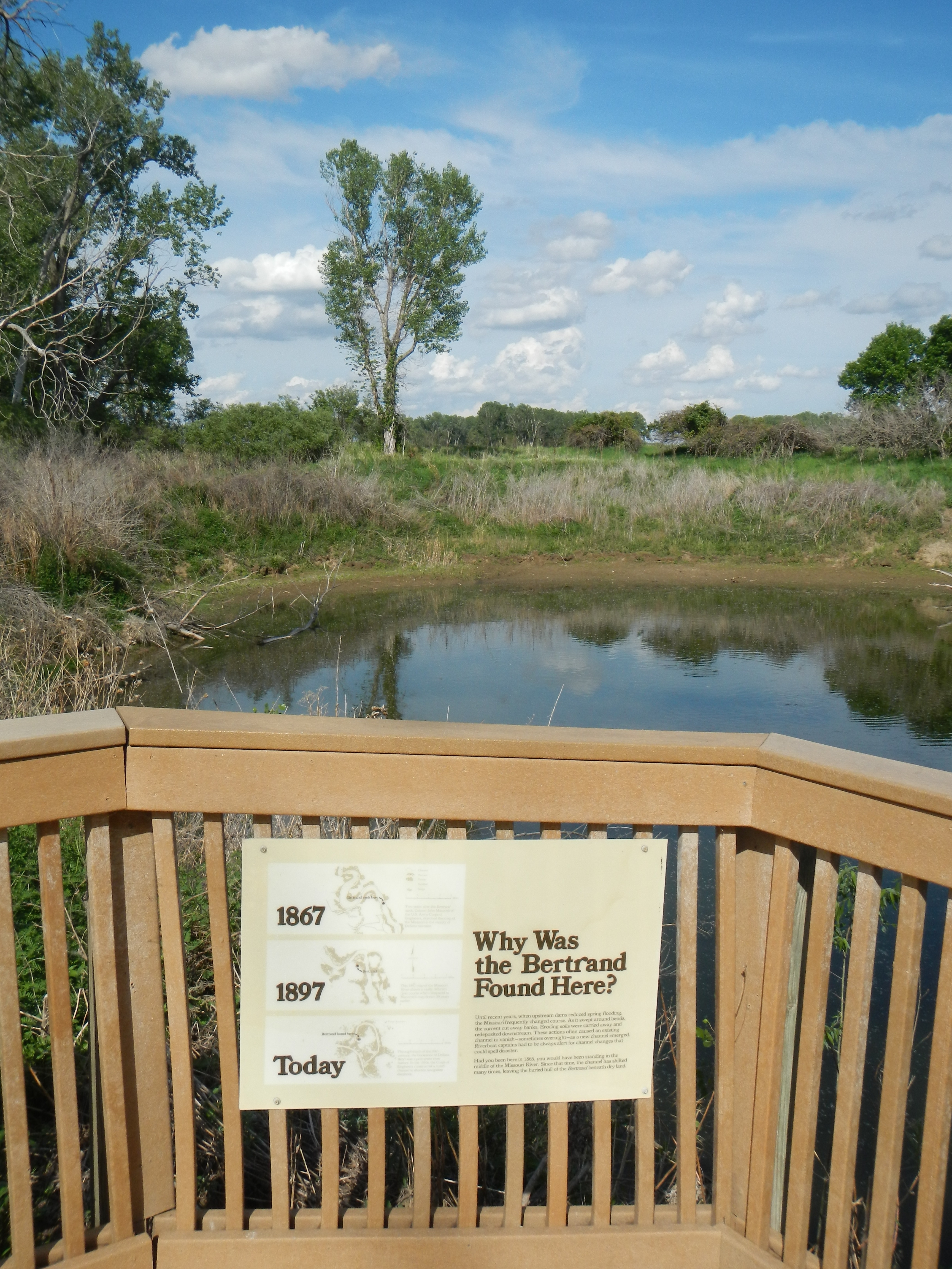
The Bertrand Excavation Site | Additional Description:
Why Was the Bertrand Found Here?
Until recent years, when the upstream dams reduced spring flooding, the Missouri frequently changed course. As it swept around bends, the currents cut away banks. Eroding soils were carried away and redeposited downstream. These actions often caused an existing channel to vanish - sometimes overnight - as a new channel emerged. Riverboat captains had to be always alert for channel changes that could spell disaster.
Had you been here in 1865, you would have been standing in the middle of the Missouri River. Since that time, the channel has shifted many times, leaving the buried hull of the
Bertrand beneath dry land.
Captions:
1867 Two years after the
Bertrand sank, Colonel John Macomb of the U.S. Army Corps of Engineers, sketched this map of the Missouri in the vicinity of DeSoto townsite;
1897 This 1897 map of the Missouri River shows a vastly different river course when compared to Macomb’s map drawn 30 years earlier.;
Today Through much of the 20th century, the horseshoe of DeSoto Bend, was a prominent river feature. In the 1950s, the Corps of Engineers constructed a cutoff channel to shorten navigation distances.
Submitted: June 3, 2014, by Barry Swackhamer of Brentwood, California.
Database Locator Identification Number: p274931
File Size: 3.440 Megabytes
To see the metadata that may be embedded in this photo, sign in and then return to this page.