Photograph as originally submitted to
this page in the Historical Marker Database
www.HMdb.org.
Click on photo to resize in browser. Scroll down to see metadata.
Photographer: Rev. Ronald Irick
Taken: July 8, 2014
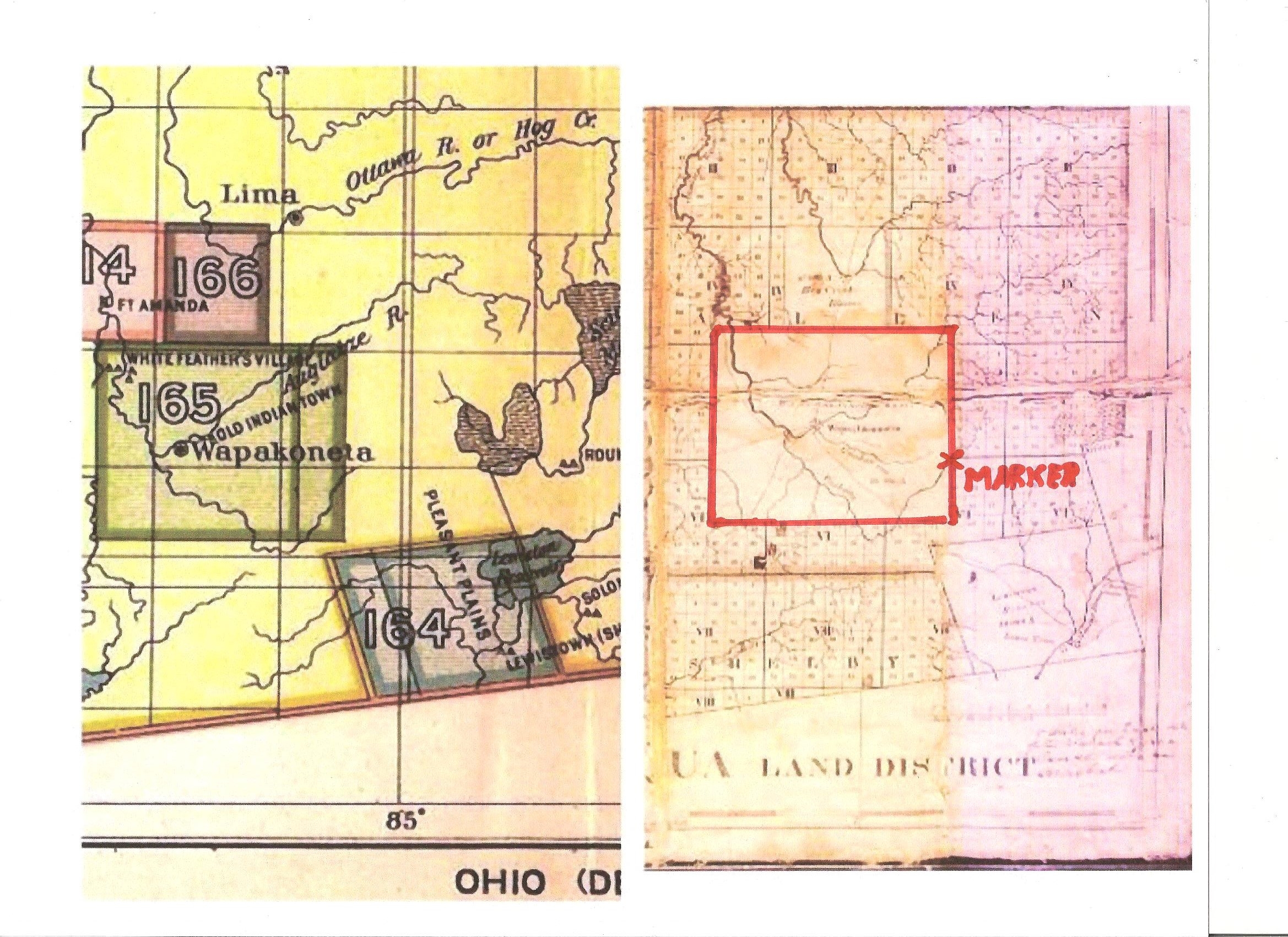
Caption:
Wapaghonetta Reservation Map | Additional Description: part of Royce Land Cession map,with Piqua Land District map, edited, marked and colored by Dr. Ronald Irick, comparing lay out of Wapaghonetta Reservation, and showing location of subject marker.
Submitted: July 8, 2014, by Rev. Ronald Irick of West Liberty, Ohio.
Database Locator Identification Number: p278517
File Size: 1.017 Megabytes
To see the metadata that may be embedded in this photo, sign in and then return to this page.