Photograph as originally submitted to
this page in the Historical Marker Database
www.HMdb.org.
Click on photo to resize in browser. Scroll down to see metadata.
Photographer: William Fischer, Jr.
Taken: July 4, 2014
Caption:
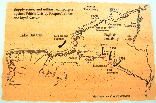
Supply Routes Map on Fort de la Présentation - 1749-1759 Marker | Submitted: July 29, 2014, by William Fischer, Jr. of Scranton, Pennsylvania.
Database Locator Identification Number: p280590
File Size: 0.120 Megabytes
To see the metadata that may be embedded in this photo, sign in and then return to this page.