Photograph as originally submitted to
this page in the Historical Marker Database
www.HMdb.org.
Click on photo to resize in browser. Scroll down to see metadata.
Photographer: Dale K. Benington
Taken: July 10, 2014
Caption:
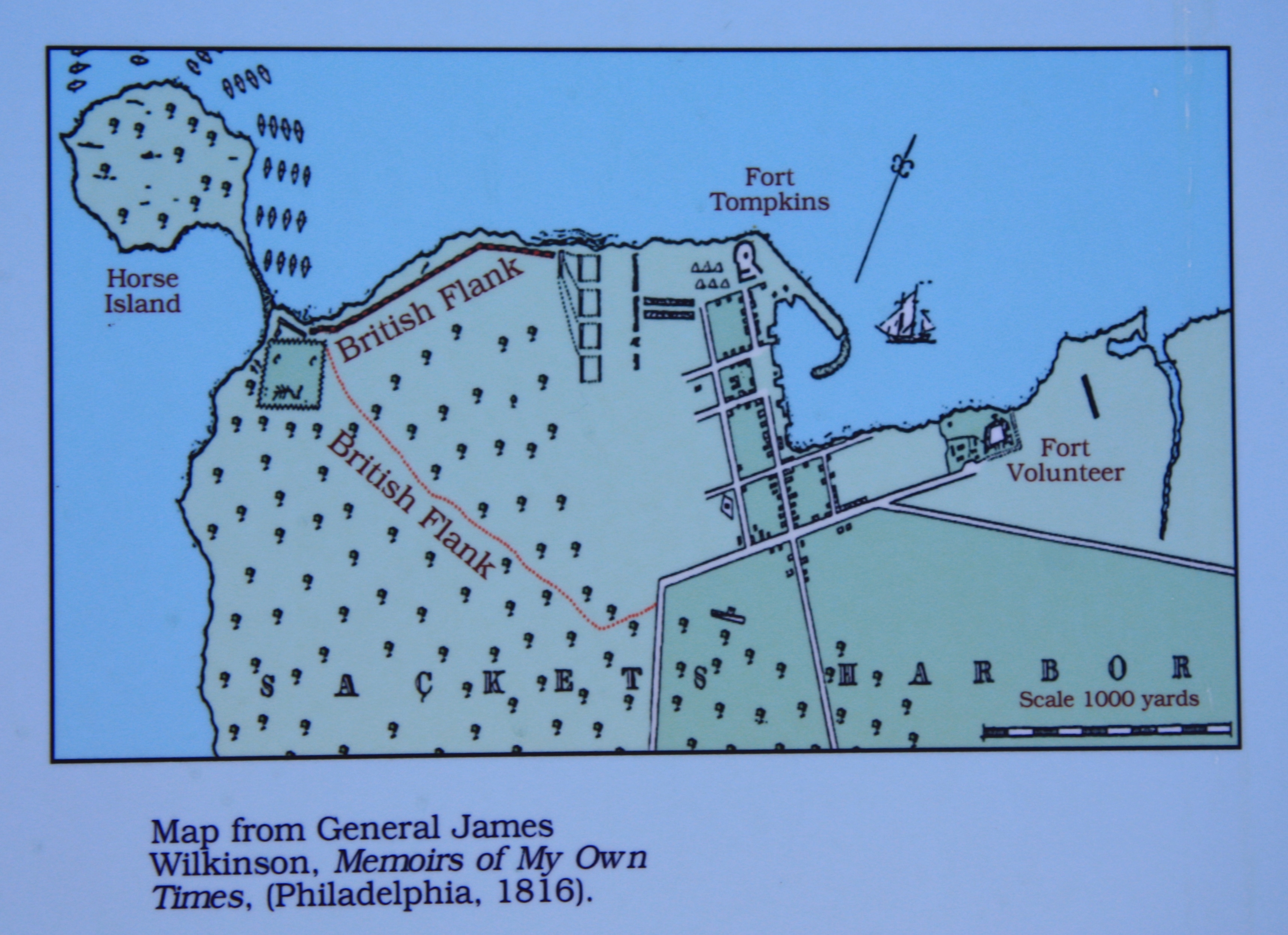
The Landing Area Marker | Additional Description: A close-up view of the map of Sackets Harbor, showing the initial movement of the British forces when they launched their attack from Horse Island.
Submitted: August 2, 2014, by Dale K. Benington of Toledo, Ohio.
Database Locator Identification Number: p281066
File Size: 2.089 Megabytes
To see the metadata that may be embedded in this photo, sign in and then return to this page.