Photograph as originally submitted to
this page in the Historical Marker Database
www.HMdb.org.
Click on photo to resize in browser. Scroll down to see metadata.
Photographer: Allen C. Browne
Taken: August 2, 2014
Caption:
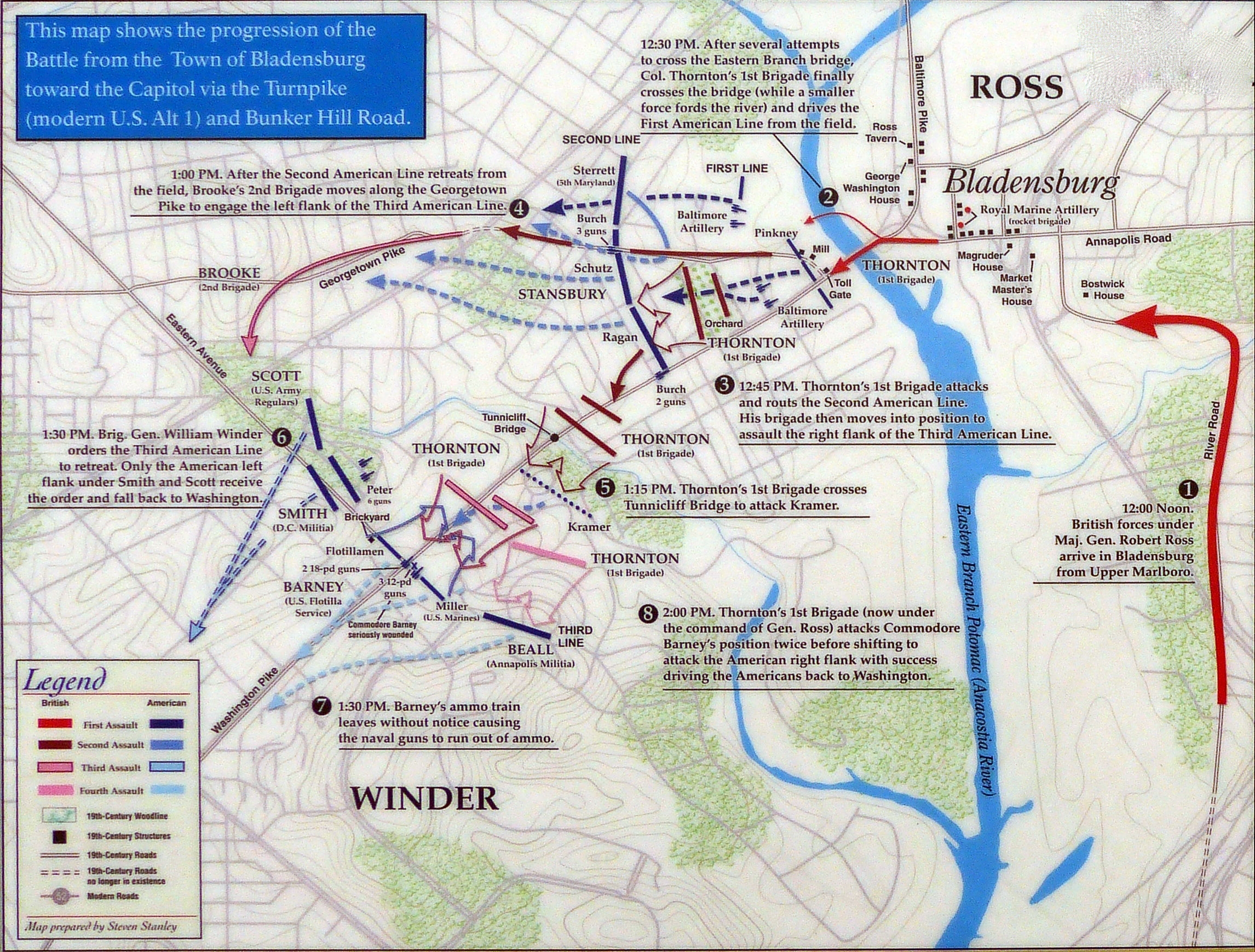
Map | Additional Description: This map shows the progression of the Battle from the Town of Bladensburg toward the Capitol via the turnpike (Modern U.S. Alt 1) and Bunker Hill Road.
Close-up of map on markerSubmitted: August 4, 2014, by Allen C. Browne of Silver Spring, Maryland.
Database Locator Identification Number: p281368
File Size: 1.273 Megabytes
To see the metadata that may be embedded in this photo, sign in and then return to this page.