Photograph as originally submitted to
this page in the Historical Marker Database
www.HMdb.org.
Click on photo to resize in browser. Scroll down to see metadata.
Photographer: Rev. Ronald Irick
Taken: August 26, 2014
Caption:
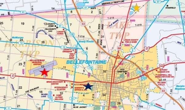
Bellefontaine Airport Pylon Marker | Additional Description: map showing various locations of this marker. Blue star is the original location, at Tanger's Airport, from 1948 to 1962. Yellow Star marks the "new" Bellefontaine Municipal Airport", now abandoned. Red star indicates current location at Bellefontaine Regional Airport.
Map marked and colored by Dr. Ronald Irick, using Logan County Engineer's current highway map, from Engineer's web- site.
Submitted: August 26, 2014, by Rev. Ronald Irick of West Liberty, Ohio.
Database Locator Identification Number: p283824
File Size: 0.096 Megabytes
To see the metadata that may be embedded in this photo, sign in and then return to this page.