Photograph as originally submitted to
this page in the Historical Marker Database
www.HMdb.org.
Click on photo to resize in browser. Scroll down to see metadata.
Photographer: Rev. Ronald Irick
Taken: September 28, 2014
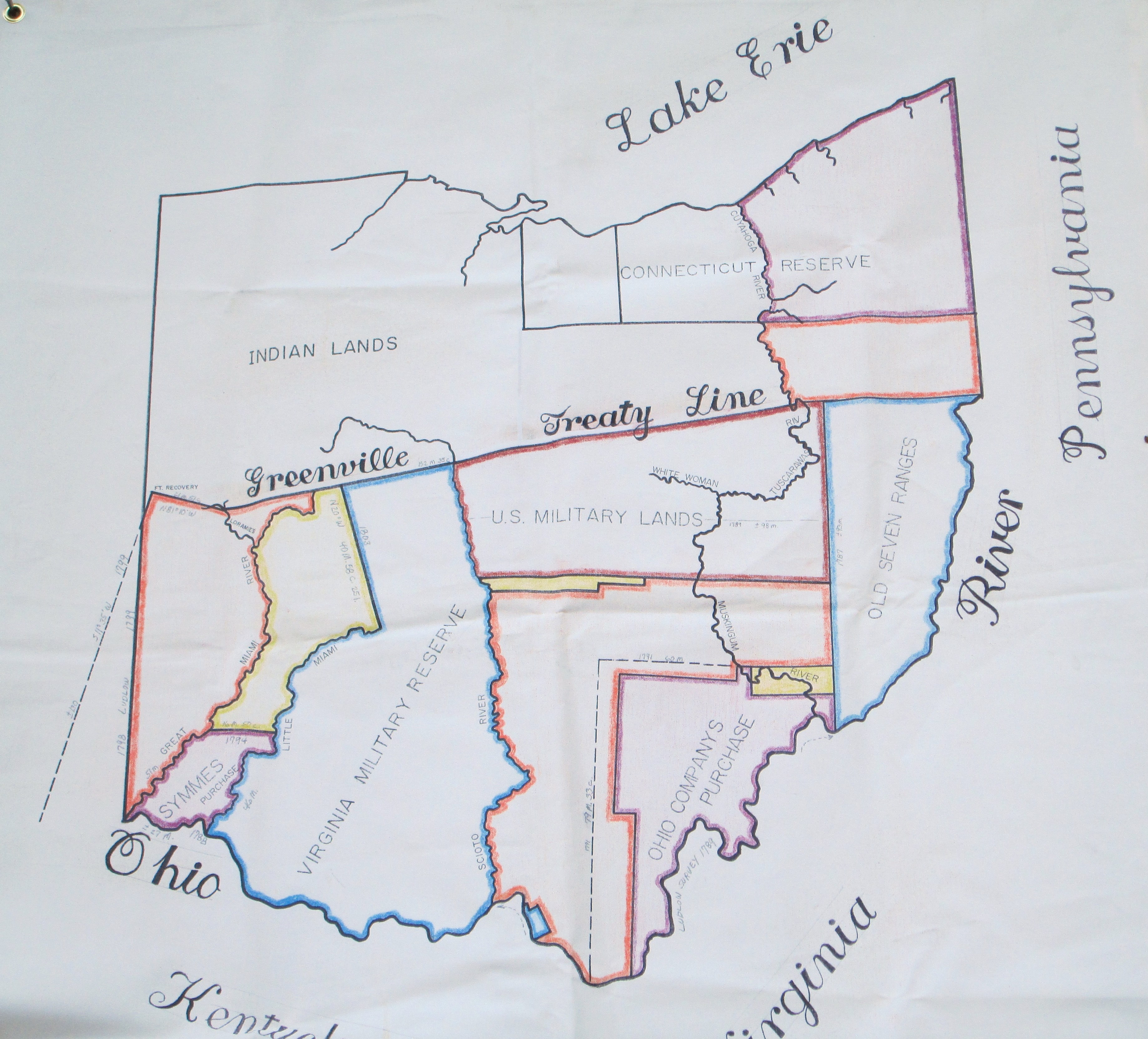
Caption:
Greenville Treaty Line Map | Additional Description: James Williams' map, showing much of Israel Ludlow's work.
Submitted: September 28, 2014, by Rev. Ronald Irick of West Liberty, Ohio.
Database Locator Identification Number: p287306
File Size: 2.172 Megabytes
To see the metadata that may be embedded in this photo, sign in and then return to this page.