Photograph as originally submitted to
this page in the Historical Marker Database
www.HMdb.org.
Click on photo to resize in browser. Scroll down to see metadata.
Photographer: Don Morfe
Taken: August 22, 2014
Caption:
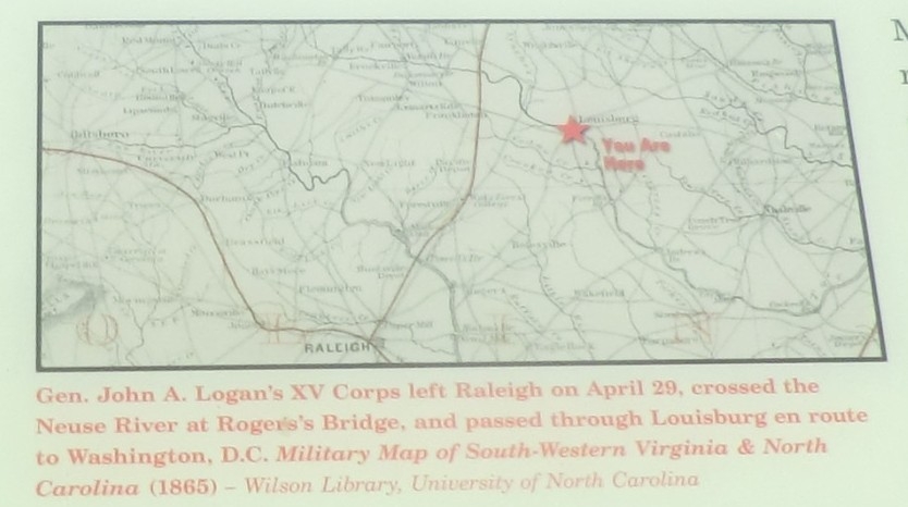
Close up of the map | Additional Description: (Inscription below the map) Gen. John A. Logan’s XV Corps left Raleigh on April 29, crossed the Neuse River at Rogers’s Bridge, and passed through Louisburg en route to Washington, D.C. Military Map of South-Western Virginia and North Carolina (1865)-Wilson Library, University of North Carolina.
Submitted: October 11, 2014, by Don Morfe of Baltimore, Maryland.
Database Locator Identification Number: p288568
File Size: 0.087 Megabytes
To see the metadata that may be embedded in this photo, sign in and then return to this page.