Photograph as originally submitted to
this page in the Historical Marker Database
www.HMdb.org.
Click on photo to resize in browser. Scroll down to see metadata.
Photographer: Barry Swackhamer
Taken: June 15, 2014
Caption:
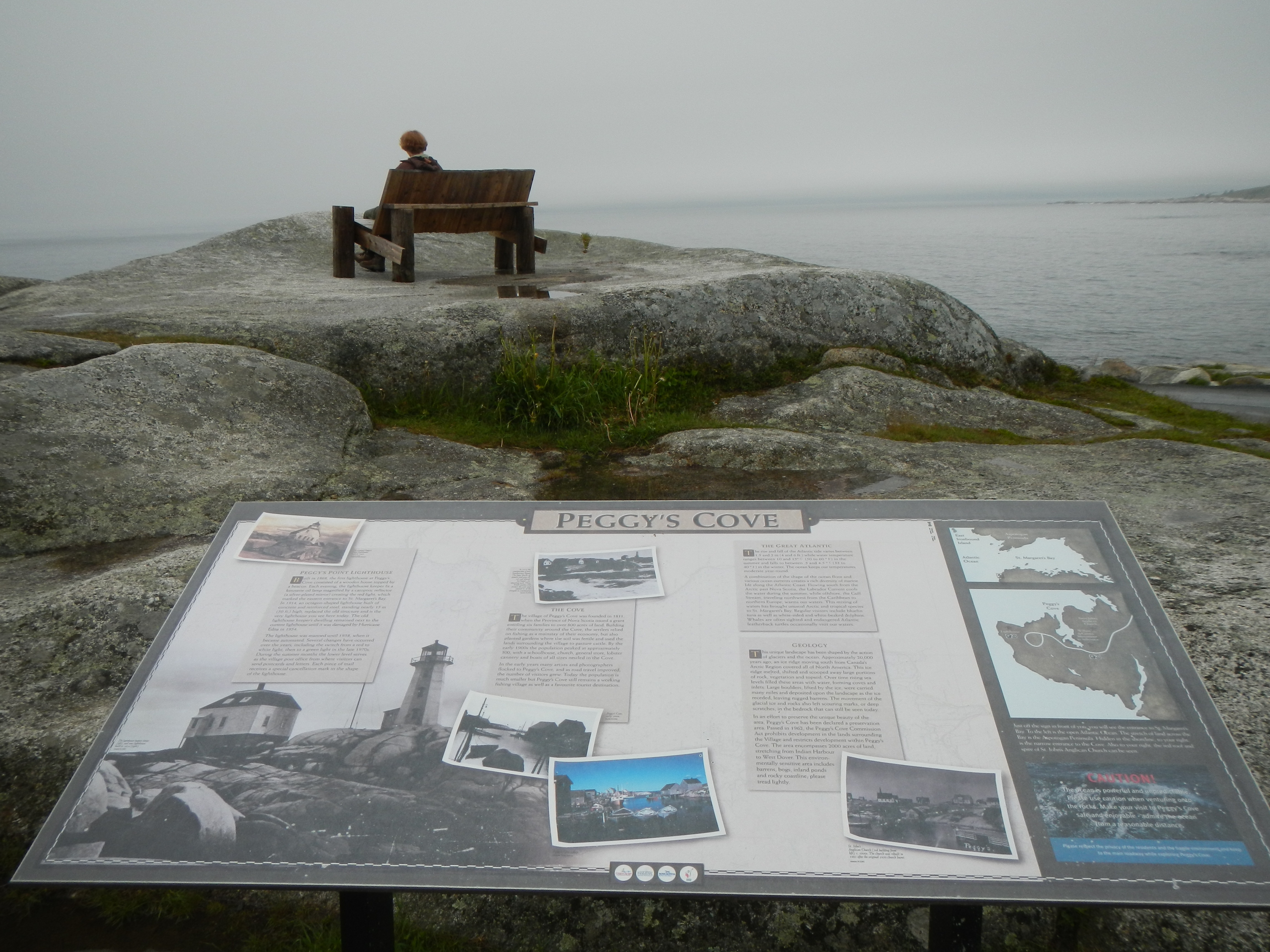
Peggy's Cove Marker | Additional Description: Captions: (top left) The original Peggy’s Point Lighthouse built in 1868,; (bottom left, background photo) The lighthouse keeper’s house and the new lighthouse built in 1914; (center top) In 1935 the construction of two breakwaters began. The huge blocks of granite used were all cut and placed by hand - a amazing task. These break-waters still protect the cove and remind us of the strength of community.; (center bottom) Peggy’s Cove, early 1900s; Peggy’s Cove, today; (bottom left) St. John’s Anglican Church (3rd building from left) c. 1900s. The church was rebuilt in 1883 after the original 1859 church burnt.; (sidebar on right) Just off the sign in front of you you will see the entrance to St. Margaret’s Bay. To the left is the open Atlantic Ocean. The stretch of land across the Bay is the Aspotogan Peninsula. Hidden in shoreline, to your right, is the narrow entrance to the Cove. Also to your right, the red roof and spire of St. John’s Anglican Church can be seen. CAUTION! The ocean is powerful and unpredictable. Please use caution when venturing onto the rocks. Make your visit to Peggy’s Cove sage and enjoyable - admire the ocean from a reasonable distance.
Submitted: October 13, 2014, by Barry Swackhamer of Brentwood, California.
Database Locator Identification Number: p288758
File Size: 3.394 Megabytes
To see the metadata that may be embedded in this photo, sign in and then return to this page.