Photograph as originally submitted to
this page in the Historical Marker Database
www.HMdb.org.
Click on photo to resize in browser. Scroll down to see metadata.
Photographer: Barry Swackhamer
Taken: June 15, 2014
Caption:
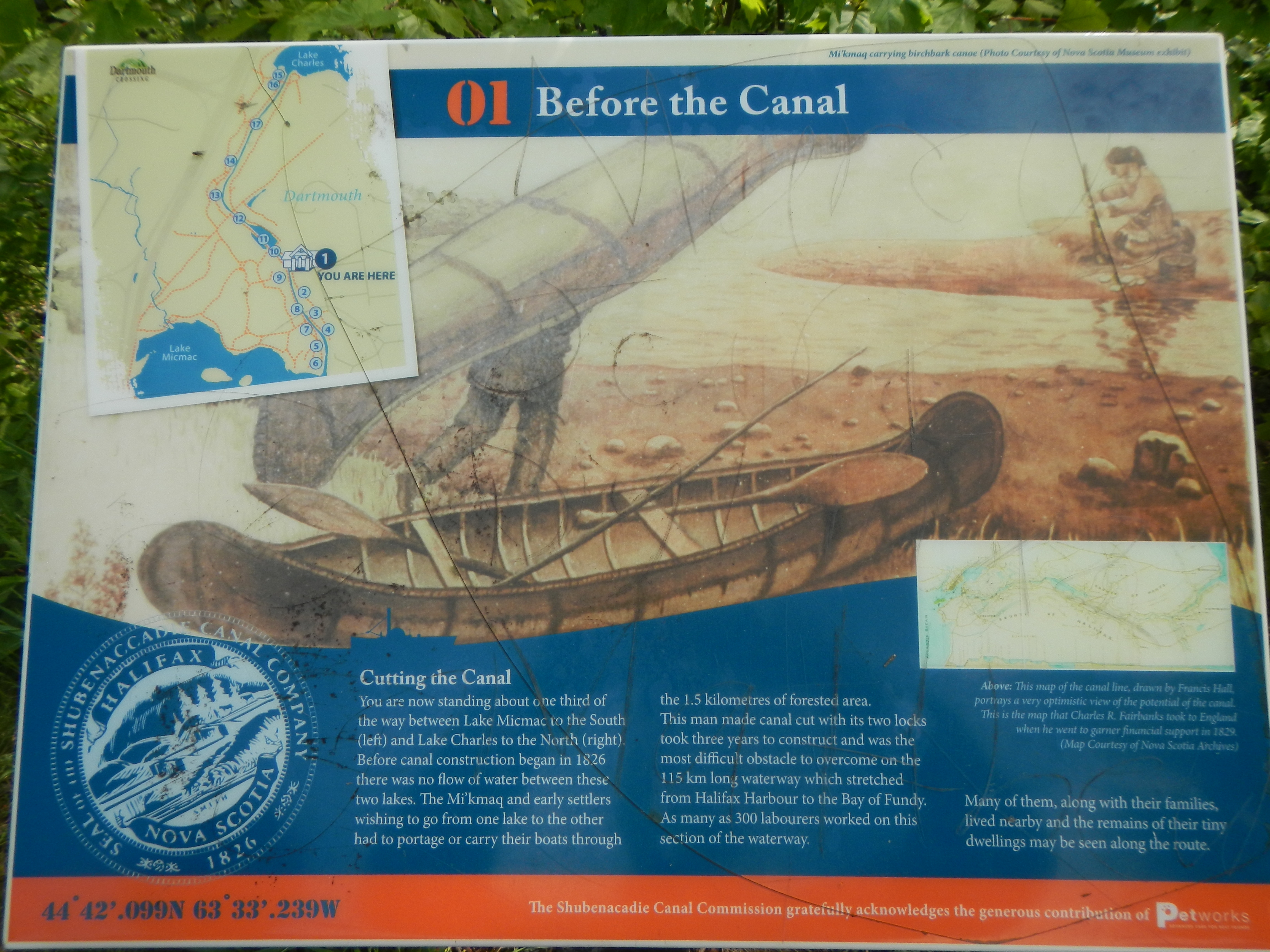
Before the Canal Marker | Additional Description: Caption: Above: This map of the canal line, drawn by Francis Hall, portrays a very optimistic view of the potential canal. This is the map that Charles R. Fairbanks took to England when he went to garner financial support in 1829. (Map Courtesy of Nova Scotia Archives).
Submitted: October 14, 2014, by Barry Swackhamer of Brentwood, California.
Database Locator Identification Number: p288929
File Size: 3.326 Megabytes
To see the metadata that may be embedded in this photo, sign in and then return to this page.