Photograph as originally submitted to
this page in the Historical Marker Database
www.HMdb.org.
Click on photo to resize in browser. Scroll down to see metadata.
Photographer: Barry Swackhamer
Taken: June 14, 2014
Caption:
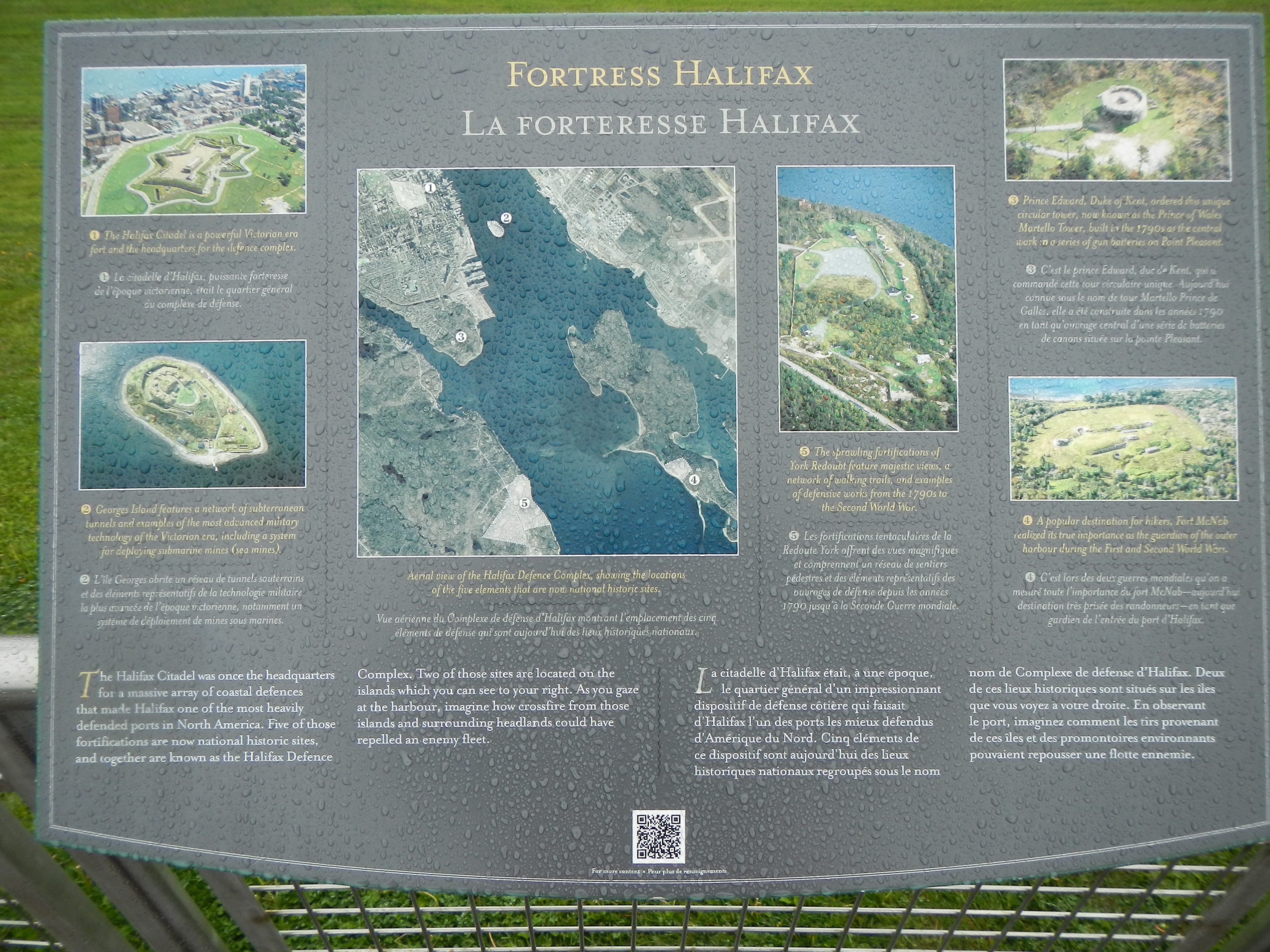
Fortress Halifax / La forteresse Halifax Marker | Additional Description: Captions (English / French): (center photograph then clockwise from the top left) Aerial view of the Halifax Defence Complex, showing the locations of the five elements that are now national historic sites. / Vue aérienne du Complexe de défense d’Halifax montrant l’emplacement des cinq éléments de defense qui sont aujourd’hui des lieux historiques nationaux.; 1) The Halifax Citadel is a powerful Victorian era fort an the headquarters for the defence complex. / Le citadelle d’Halifax, puissante fortress de l’époque victorienne, était le quartier général du complexe de défense.; 3) Prince Edward, Duke of Kent, ordered this unique circular tower, now known as the Prince of Wales Martello Tower, built in the 1790s as the central work in a series of gun batteries on Point Pleasant. / C’est le prince Edward, duc de Kent, qui a commandé cette tour circulaire unique. Aujourd’hui connue sous le nom de tour Martello Prince de Galles, elle a été construite dans les années 1790 en tant qu’ouvrage central d’une série de batteries de canons située sur la point Pleasant.; 4) A popular destination for hikers, Fort McNab realized its true importance as the guardian of the outer harbour during the First and Second World Wars. / C’est lors des deux guerres mondiales qu’on a mesuré toute l’importance du fort McNab - aujourd’hui destination très prisée des randonneurs - en tant que gardien de l’entrée du port d’Halifax.; 5) The sprawling fortifications of York Redoubt feature majestic views, a network of walking trails, and examples of defensive works from the 1790s to the Second World War. / Les fortifications tentaculaires de la Redoute York offrent des vues magnifiques et comprennent un réseau de sentiers pédestres et des éléments représentatifs des ouvrages défense depuis les années 1790 jusqu’à la Seconde Guerre mondiale.; 2) Georges Island features a network of subterranean tunnels and examples of the most advanced military technology ot the Victorian era, including a system for deploying submarine mines (sea mines). / L’île Georges abrite un réseau de tunnels souterrains et des éléments représentatifs de la technologie militaire la plus avancée de l’époque victorienne, notamment un système de déploiement des mines sou marines.
Submitted: October 24, 2014, by Barry Swackhamer of Brentwood, California.
Database Locator Identification Number: p289961
File Size: 3.622 Megabytes
To see the metadata that may be embedded in this photo, sign in and then return to this page.