Photograph as originally submitted to
this page in the Historical Marker Database
www.HMdb.org.
Click on photo to resize in browser. Scroll down to see metadata.
Photographer: Barry Swackhamer
Taken: June 17, 2014
Caption:
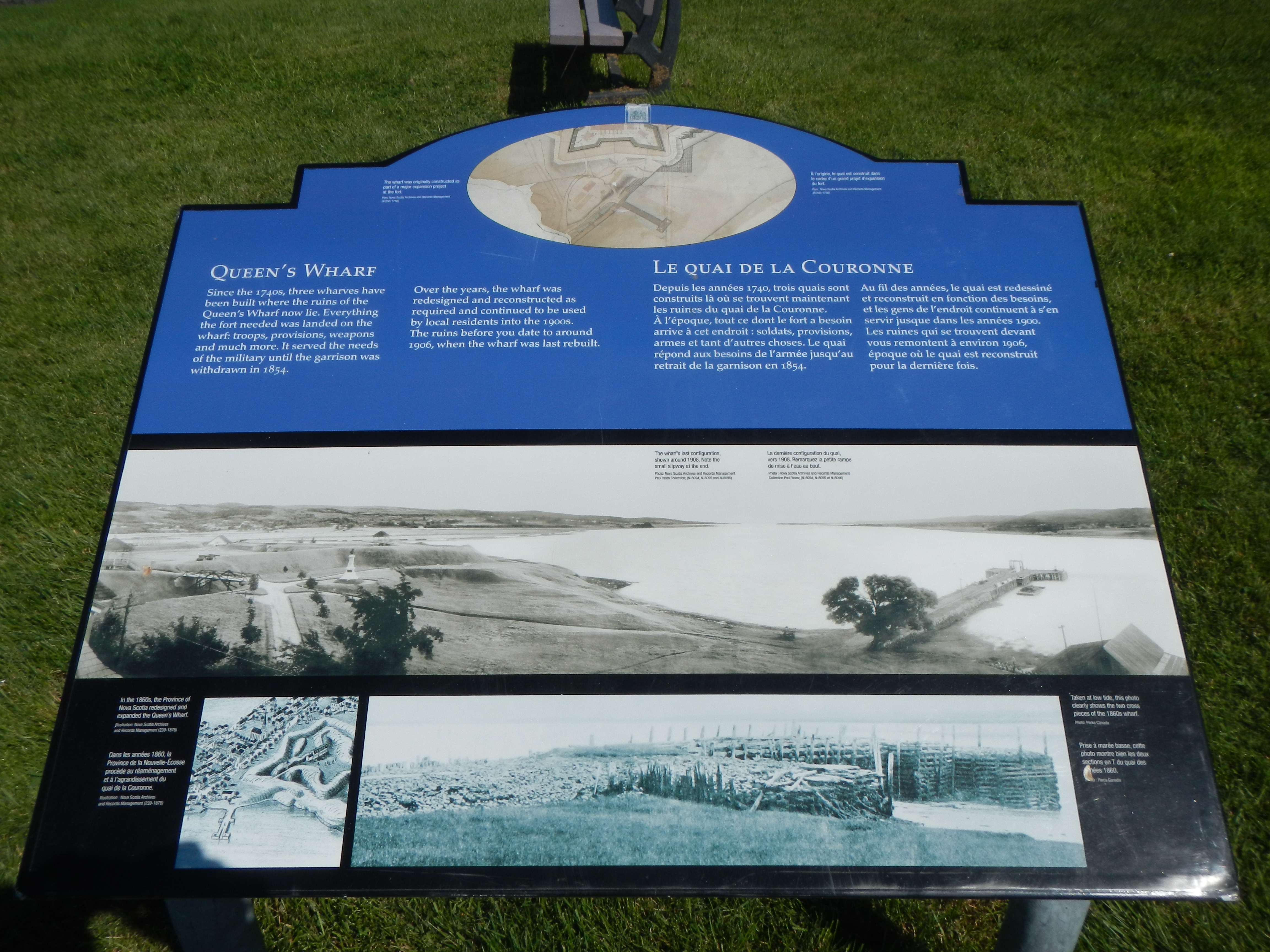
Queen’s Wharf Marker | Additional Description: Captions (English / French): (top)The wharf was originally constructed as part of a major expansion project at the fort. / À l’origine, le quai construit dans le dare d’un grand projet d’expansion du fort.; (center) The wharf’s last configuration, shown around 1908, Note the small slipway at the end. / La dernière configuration du quai, vers 1908. Remarquez la petite rampe de mise à l’eau au bout.; (bottom, left) In the 1860’s, the Province of Nova Scotia redesigned and expanded the Queen’s Wharf. / Dans les années 1860, la Province de la Nouvelle-Écosse procède au réaménagement et à l’agrandissement du quai de la Couronne.; (bottom, right) Taken at low tide, this photo clearly shows the two cross pieces of the 1860s wharf. / Prise à marée basse, cette photo montre bien les deux sections en T du quai des années 1860.
Submitted: November 1, 2014, by Barry Swackhamer of Brentwood, California.
Database Locator Identification Number: p290714
File Size: 3.254 Megabytes
To see the metadata that may be embedded in this photo, sign in and then return to this page.