Photograph as originally submitted to
this page in the Historical Marker Database
www.HMdb.org.
Click on photo to resize in browser. Scroll down to see metadata.
Photographer: Barry Swackhamer
Taken: June 17, 2014
Caption:
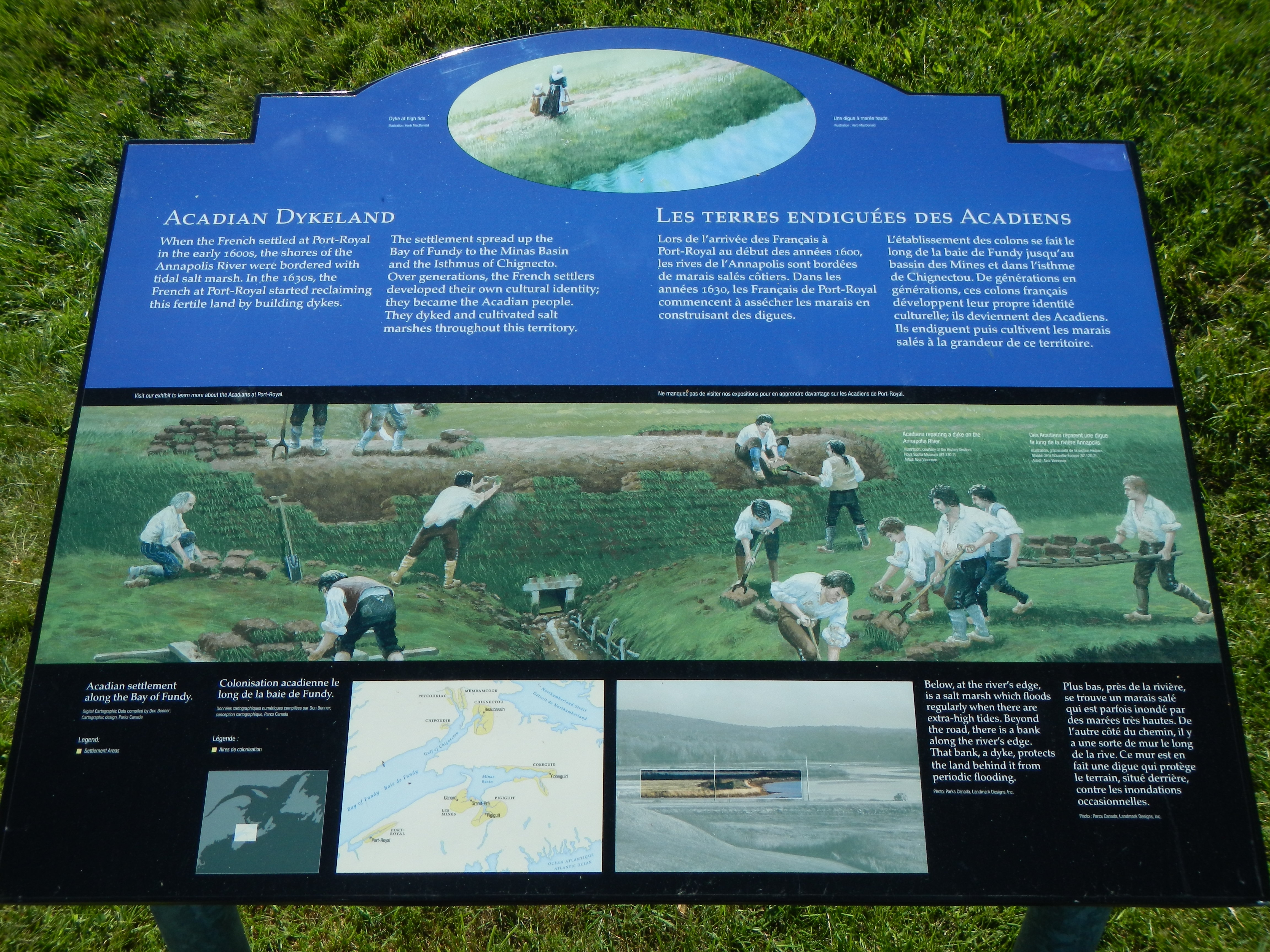
Acadian Dykeland Marker | Additional Description: Captions (English / French): (top) Dyke at high tide. Une digue à marée haute.; Visit our exhibit to learn more about the Acadians at Port-Royal. / Ne manquez pas de visiter nos expositions pour en apprendre divagate sur les Acadiens de Port-Royal.; (bottom row) Acadian settlement along the Bay of Fundy. / Colonisation acadienne de long de la baie de Fundy.; Below, at the river’s edge, is a salt marsh which floods regularly when there are extra-high tides. Beyond the road, there is a bank along the river’s edge. That bank, a dyke, protects the land behind it from periodic flooding. / Plus bas, près de la rivière, se trouvé un marais salé qui est parfois inondé par des marées très hautes. De l’autre côté du chemin, il y a une sort de mur le long de la rive. Ce mur est en fait une digue qui protège le terrain, situé derriere contre les inondations occasionnelles.
Submitted: November 2, 2014, by Barry Swackhamer of Brentwood, California.
Database Locator Identification Number: p290881
File Size: 3.077 Megabytes
To see the metadata that may be embedded in this photo, sign in and then return to this page.