Photograph as originally submitted to
this page in the Historical Marker Database
www.HMdb.org.
Click on photo to resize in browser. Scroll down to see metadata.
Photographer: Cosmos Mariner
Taken: June 7, 2012
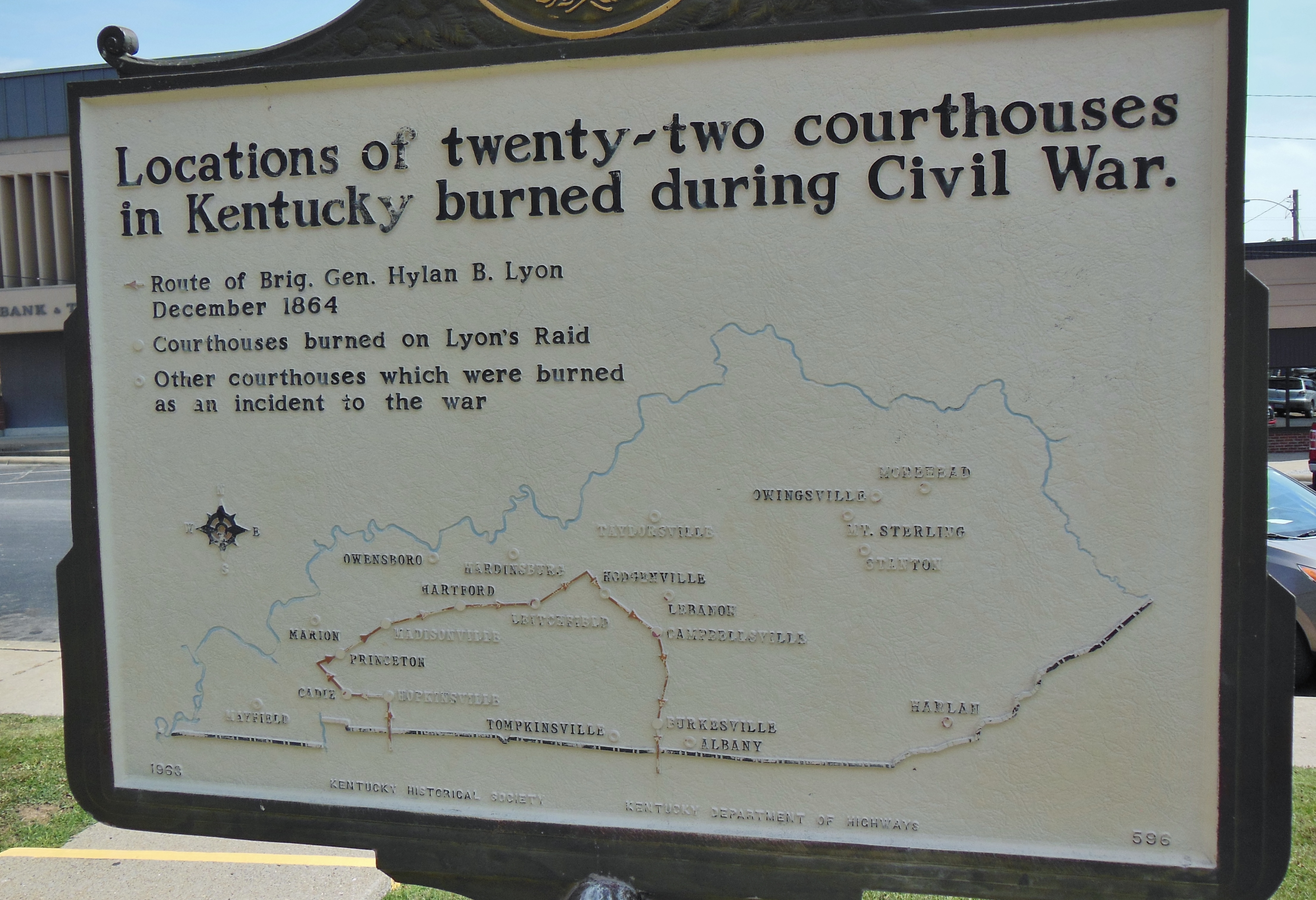
Caption:
Map of Kentucky Courthouses Burned During Civil War | Additional Description:
Back side of nearby "Courthouse Burned" marker shows map of 22 Kentucky courthouses burned during the Civil War, including the original Crittenden County Courthouse here in Marion.
Submitted: November 26, 2014, by Cosmos Mariner of Cape Canaveral, Florida.
Database Locator Identification Number: p293351
File Size: 4.390 Megabytes
To see the metadata that may be embedded in this photo, sign in and then return to this page.