Photograph as originally submitted to
this page in the Historical Marker Database
www.HMdb.org.
Click on photo to resize in browser. Scroll down to see metadata.
Photographer: Rev. Ronald Irick
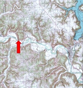
Caption:
Boundary Hill site | Additional Description: the Greenville Treaty Line ran from the Mouth of the Cuyahoga River, up to the Portage, down the Tuscawarus, to the Crossing Place above Fort Laurens, then across ohio to fort Loramie, then on to fort recovery. From there it ran south west across Indiana to the Ohio river, opposite the Mouth of the Kentucky River. This line created a "Gore" of land in eastern Indiana, just west of the Ohio state line. This marker is on the line as it runs southwest to the Ohio River. Another marker is about three miles further south.
Submitted: December 16, 2014, by Rev. Ronald Irick of West Liberty, Ohio.
Database Locator Identification Number: p295420
File Size: 0.063 Megabytes
To see the metadata that may be embedded in this photo, sign in and then return to this page.