Photograph as originally submitted to
this page in the Historical Marker Database
www.HMdb.org.
Click on photo to resize in browser. Scroll down to see metadata.
Photographer: Marsha A. Matson
Taken: December 2, 2014
Caption:
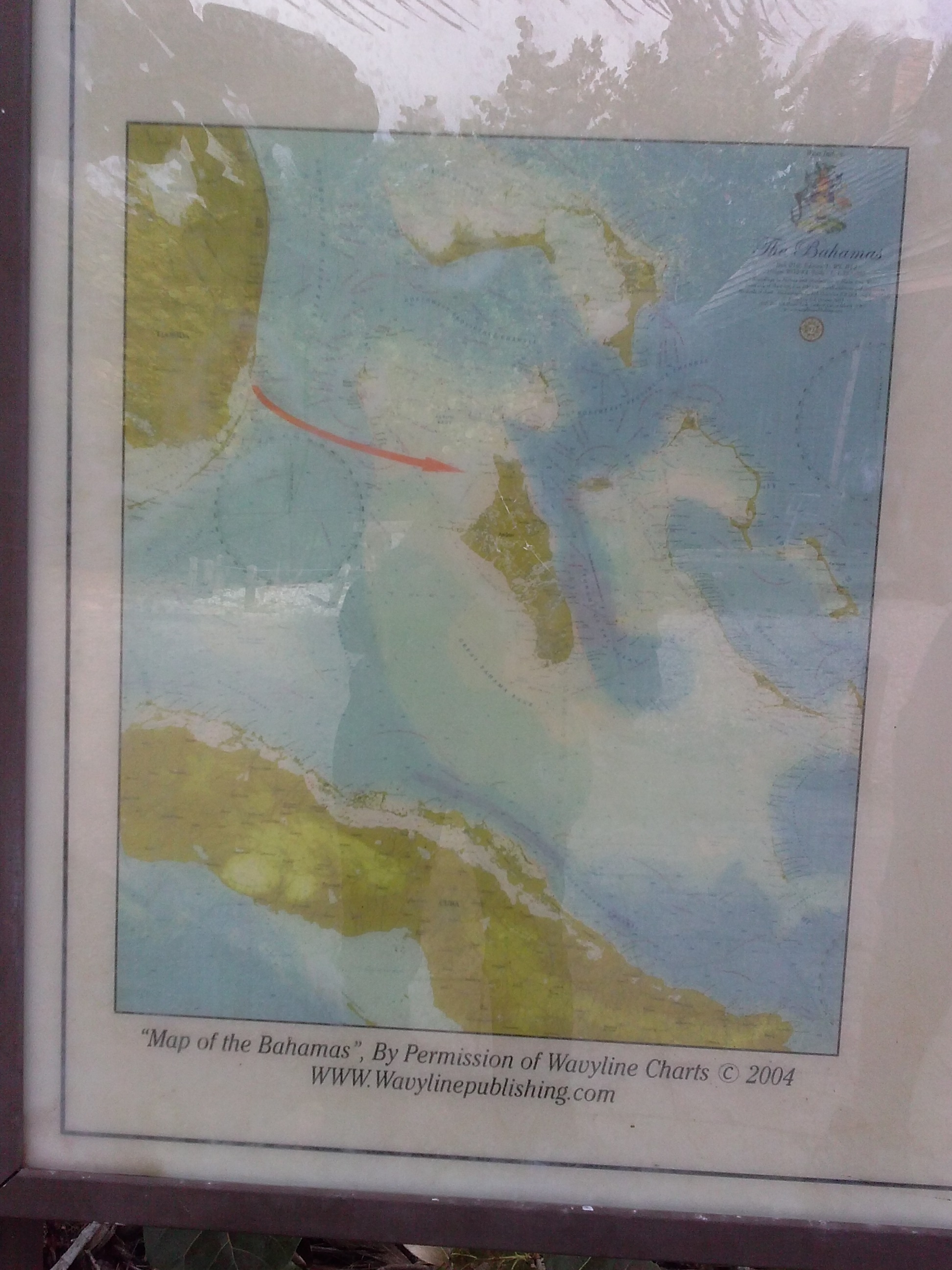
"Map of the Bahamas" on the marker | Additional Description: "Map of the Bahamas" by Permission of Wavyline Charts. c. 2004.(wavylinepublishing.com).
The red line shows the escape route taken by the slaves and Black Seminoles from Cape Florida to the Bahamas.
Submitted: December 18, 2014, by Marsha A. Matson of Palmetto Bay, Florida.
Database Locator Identification Number: p295553
File Size: 1.145 Megabytes
To see the metadata that may be embedded in this photo, sign in and then return to this page.