Photograph as originally submitted to
this page in the Historical Marker Database
www.HMdb.org.
Click on photo to resize in browser. Scroll down to see metadata.
Photographer: Barry Swackhamer
Taken: August 24, 2014
Caption:
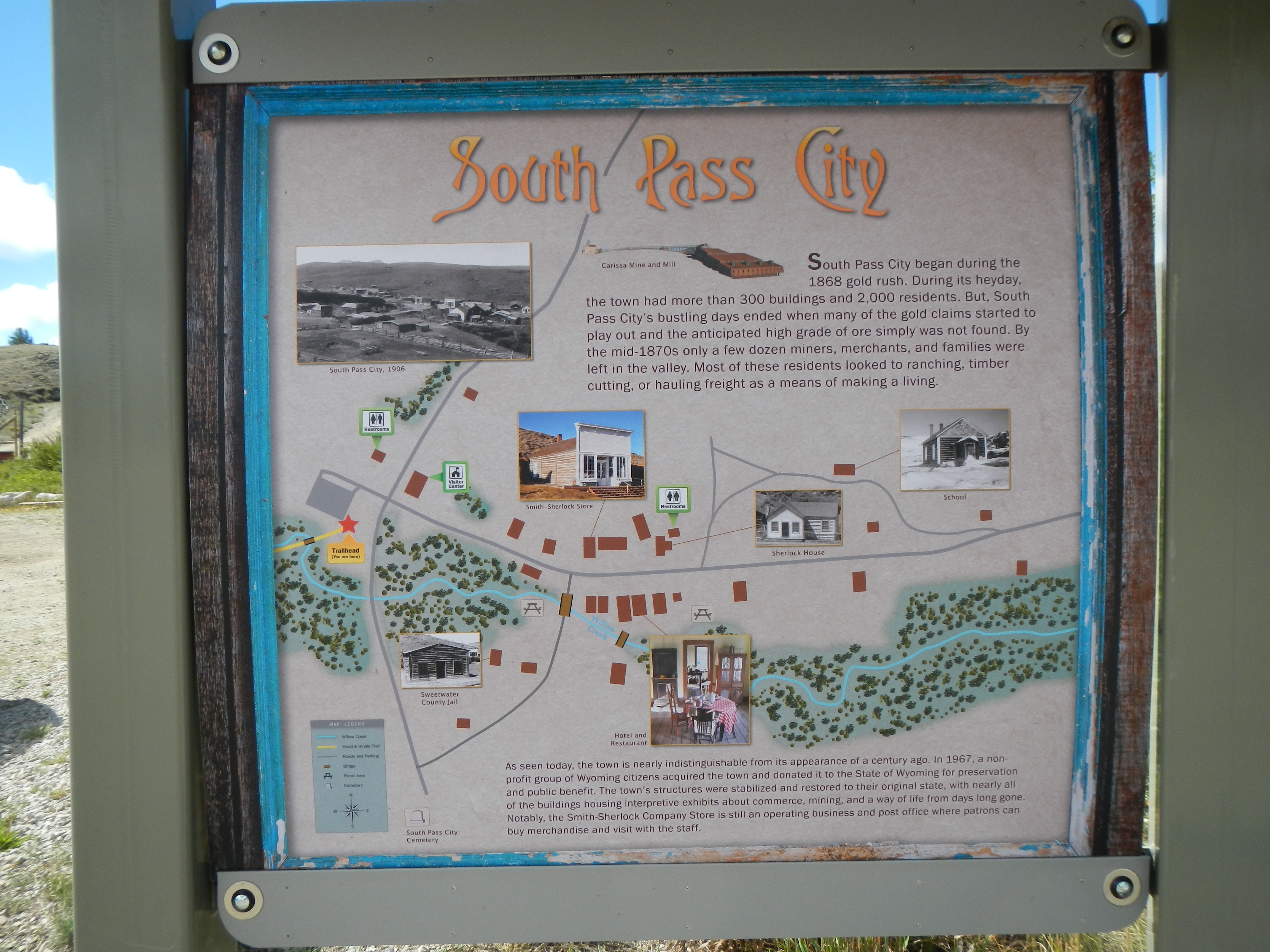
South Pass City map | Additional Description: South Pass City began during the 1868 gold rush. During it heyday, the town had more than 300 buildings and 2,000 residents. But, South Pass City’s bustling days ended when many of the gold claims started to play out and the anticipated high grade of ore simply was not found. By the mid-1870s only a few miners, merchants and families were left in the valley. Most of these residents looked to ranching, timber cutting, or hauling freight as a means of making a living.
As seen today, the town is nearly indistinguishable from its appearance of a century ago. In 1967, a non-profit group of Wyoming citizens acquired the town and donated it to the State of Wyoming for preservation and public benefit. The town’s structures were stabilized and restored to their original state, with nearly all of the buildings housing interpretive exhibits about commerce, mining, and a way of life from days long gone. Notably, the Smith-Sherlock Company Store is still an operating business and post office where patrons can by merchandise and visit with the staff.
Caption: (top left) South Pass City, 1906.
Click on the image to enlarge the map.Submitted: January 7, 2015, by Barry Swackhamer of Brentwood, California.
Database Locator Identification Number: p297668
File Size: 3.169 Megabytes
To see the metadata that may be embedded in this photo, sign in and then return to this page.