Photograph as originally submitted to
this page in the Historical Marker Database
www.HMdb.org.
Click on photo to resize in browser. Scroll down to see metadata.
Photographer: Cleo Robertson
Taken: January 24, 2015
Caption:
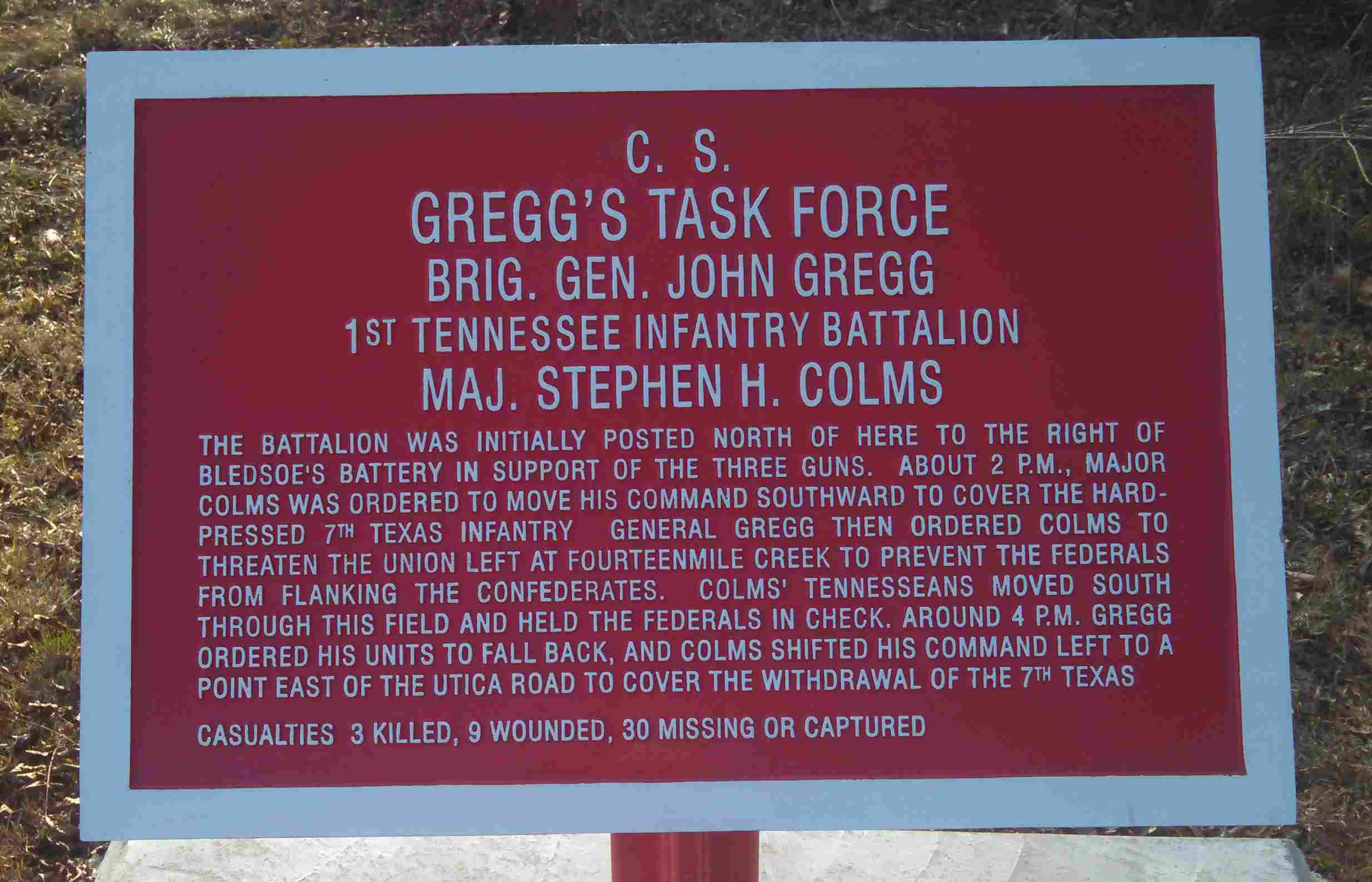
C.S. Gregg's Task Force Marker | Additional Description: One of the historical battlefield markers along the walking trail describing and expanding on the Battle of Raymond. It is located at GPS coordinates 32 14.672 N 90 26.617 W.
Submitted: February 6, 2015, by Cleo Robertson of Fort Lauderdale, Florida.
Database Locator Identification Number: p299654
File Size: 0.199 Megabytes
To see the metadata that may be embedded in this photo, sign in and then return to this page.