Photograph as originally submitted to
this page in the Historical Marker Database
www.HMdb.org.
Click on photo to resize in browser. Scroll down to see metadata.
Photographer: Library of Congress Photo
Taken: 1940
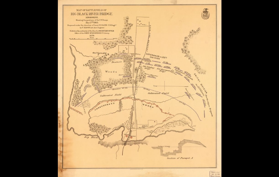
Caption:
Map of the Big Black River Bridge Battlefield | Additional Description: Map showing the positions of the U.S. troops and Confederate defenses on May 17, 1863. Published under the authority of the Office of the Chief of Engineers, U.S. Army in 1876.
Submitted: February 7, 2015, by Cleo Robertson of Fort Lauderdale, Florida.
Database Locator Identification Number: p299747
File Size: 0.488 Megabytes
To see the metadata that may be embedded in this photo, sign in and then return to this page.