Photograph as originally submitted to
this page in the Historical Marker Database
www.HMdb.org.
Click on photo to resize in browser. Scroll down to see metadata.
Photographer: Don Morfe
Taken: February 10, 2015
Caption:
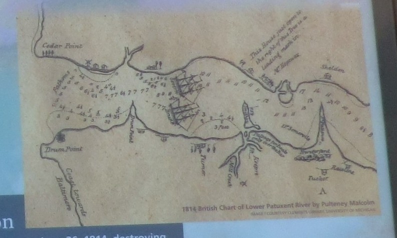
Close up of the map on the Apt Anchorage Marker | Additional Description: 1814 British Chart of Lower Patuxent River by Pulteney Malcolm
Submitted: February 27, 2015, by Don Morfe of Baltimore, Maryland.
Database Locator Identification Number: p301420
File Size: 0.094 Megabytes
To see the metadata that may be embedded in this photo, sign in and then return to this page.