Photograph as originally submitted to
this page in the Historical Marker Database
www.HMdb.org.
Click on photo to resize in browser. Scroll down to see metadata.
Photographer: Bill Coughlin
Taken: July 13, 2008
Caption:
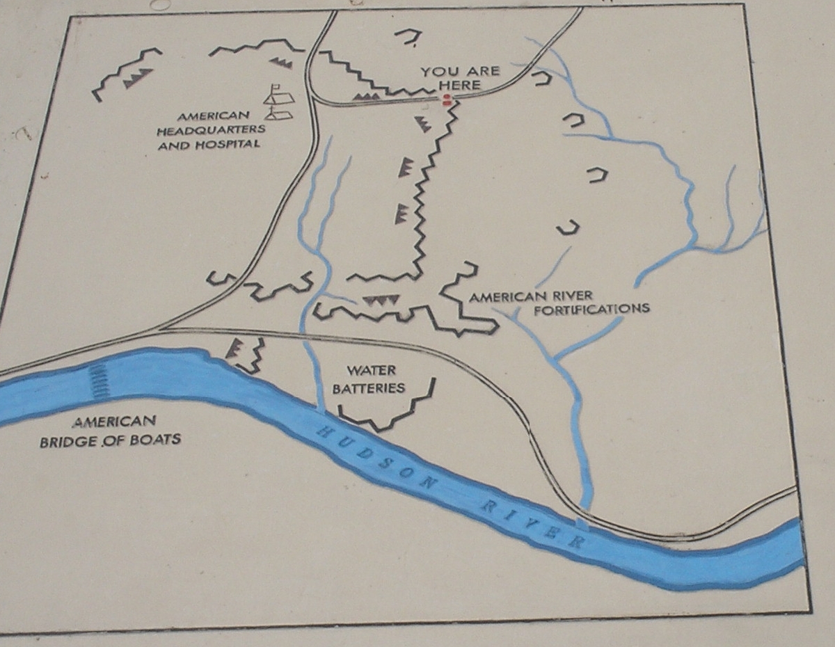
Bemis Heights Map | Additional Description: This map from the marker shows the postion of American fortifications on Bemis Heights in 1777. The site of the marker is also indicated on the map.
Submitted: August 3, 2008, by Bill Coughlin of Woodland Park, New Jersey.
Database Locator Identification Number: p30452
File Size: 3.348 Megabytes
To see the metadata that may be embedded in this photo, sign in and then return to this page.