Photograph as originally submitted to
this page in the Historical Marker Database
www.HMdb.org.
Click on photo to resize in browser. Scroll down to see metadata.
Photographer: Bill Kirchner
Taken: March 29, 2015
Caption:
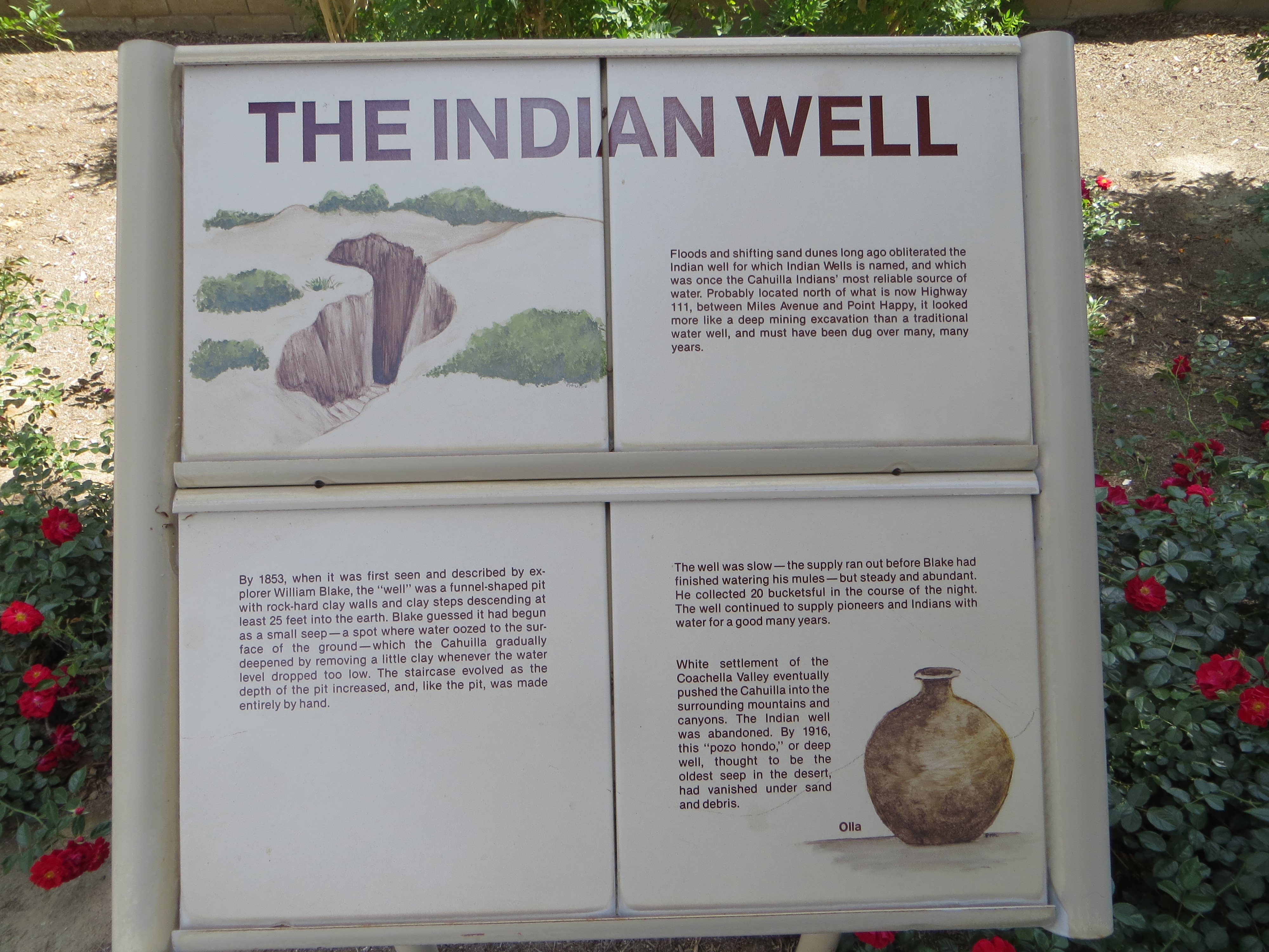
Sign near marker about the history of Indian Wells | Additional Description:
The Indian Well
Floods and shifting sand dunes long ago obliterated the Indian well for which Indian Wells in named, and which was once the Cahuilla Indians' most reliable source of water. Probably located north of what is now Highway 111, between Miles Avenue and Point Happy, it looked more like a deep mining excavation than a traditional water well, and must have been dug over many, many years.
By 1853, when it was first seen and described by explorer William Blake, the "well" was a funnel-shaped pit with rock-hard clay walls and clay steps descending at least 25 feet into the earth. Blake guessed it had begun as a small seep--a spot where water oozed to the surface of the ground--which the Cahuilla gradually deepened by removing a little clay whenever the water level dropped too low. The staircase evolved as the depth of the pit increased, and, like the pit, was made entirely by hand.
The well was slow--the supply ran out before Blake had finished watering his mules--but steady and abundant. He collected 20 bucketsful in the course of the night. The well continued to supply pioneers and Indians with water for a good many years.
White settlement of the Coachella Valley eventually pushed the Cahuilla into the surrounding mountains and canyons. The Indian well was abandoned. By 1916, this "pozo hondo," or deep well, thought to be the oldest seep in the desert, had vanished under sand and debris.
Submitted: April 4, 2015, by Bill Kirchner of Tucson, Arizona.
Database Locator Identification Number: p304567
File Size: 2.776 Megabytes
To see the metadata that may be embedded in this photo, sign in and then return to this page.