Photograph as originally submitted to
this page in the Historical Marker Database
www.HMdb.org.
Click on photo to resize in browser. Scroll down to see metadata.
Photographer: Bill Coughlin
Taken: July 13, 2008
Caption:
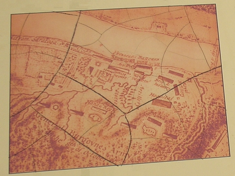
Map of British Fortifications | Additional Description: This map from the marker, drawn by a British officer, shows the fortifications built by the British after the first Battle of Saratoga.
Submitted: August 8, 2008, by Bill Coughlin of Woodland Park, New Jersey.
Database Locator Identification Number: p31039
File Size: 1.423 Megabytes
To see the metadata that may be embedded in this photo, sign in and then return to this page.