Photograph as originally submitted to
this page in the Historical Marker Database
www.HMdb.org.
Click on photo to resize in browser. Scroll down to see metadata.
Photographer: Bill Coughlin
Taken: August 10, 2008
Caption:
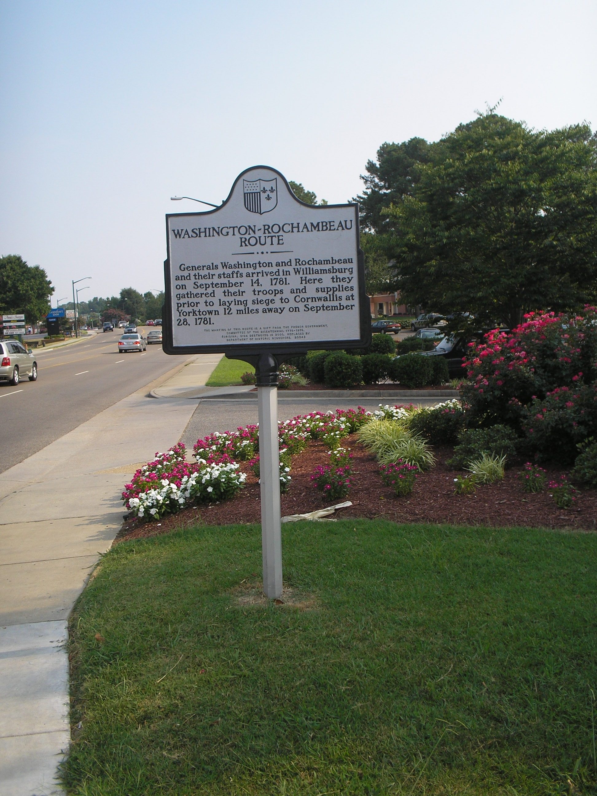
Washington – Rochambeau Route Marker | Additional Description: This marker is located north of Colonial Williamsburg. The photo looks in the direction followed by the American and French troops in 1781.
Submitted: August 10, 2008, by Bill Coughlin of Woodland Park, New Jersey.
Database Locator Identification Number: p31212
File Size: 0.848 Megabytes
To see the metadata that may be embedded in this photo, sign in and then return to this page.