Photograph as originally submitted to
this page in the Historical Marker Database
www.HMdb.org.
Click on photo to resize in browser. Scroll down to see metadata.
Photographer: Dale K. Benington
Taken: June 22, 2015
Caption:
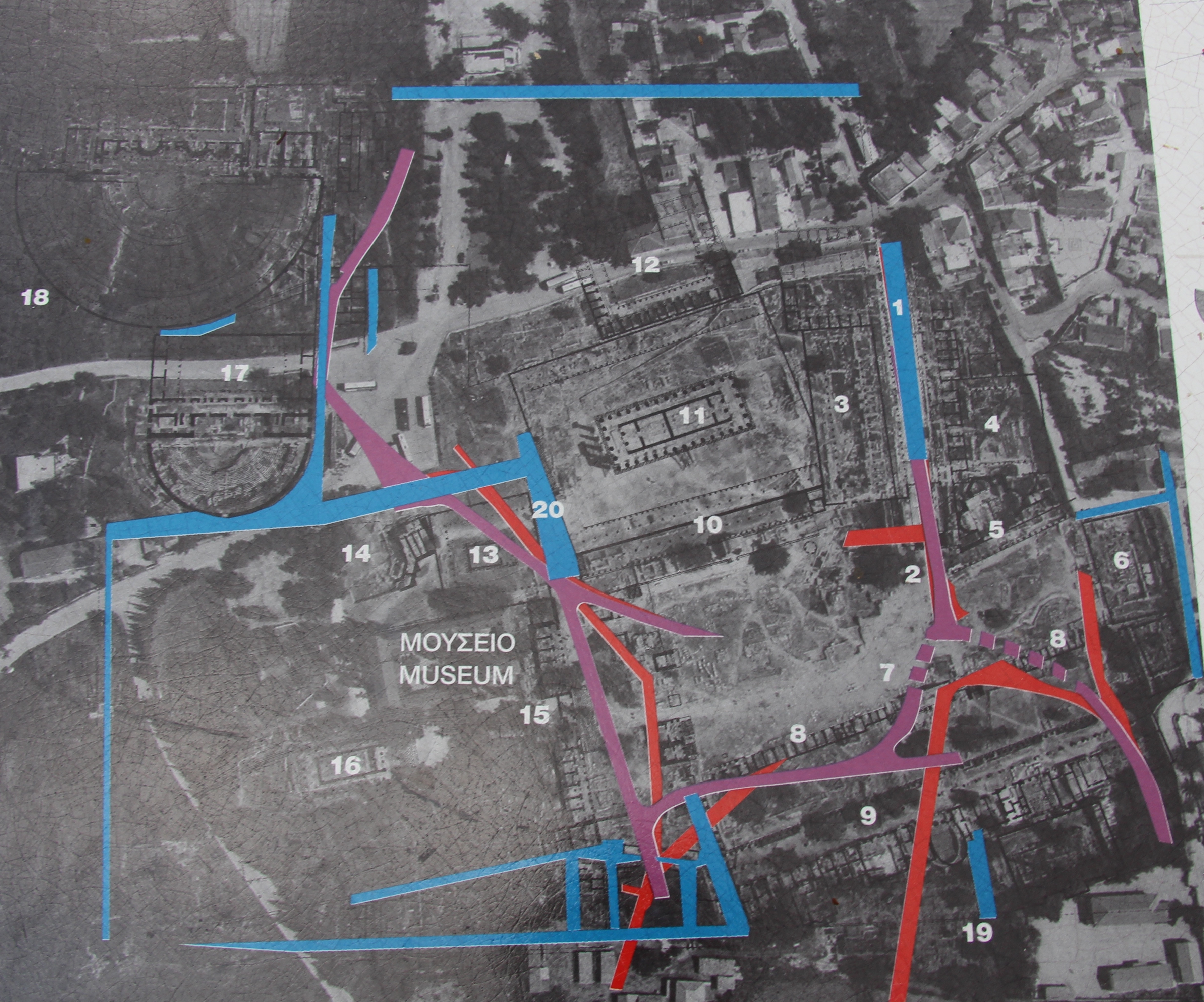
Road Network Marker | Additional Description: Close-up view, that is displayed on the marker, of a satellite photograph of Old Corinth, showing the current ruins with the ancient buildings (numbered) and roadways (color highlighted) superimposed on the photo.
Submitted: July 1, 2015, by Dale K. Benington of Toledo, Ohio.
Database Locator Identification Number: p313190
File Size: 3.476 Megabytes
To see the metadata that may be embedded in this photo, sign in and then return to this page.