Photograph as originally submitted to
this page in the Historical Marker Database
www.HMdb.org.
Click on photo to resize in browser. Scroll down to see metadata.
Photographer: Gary Nigh
Taken: August 2008
Caption:
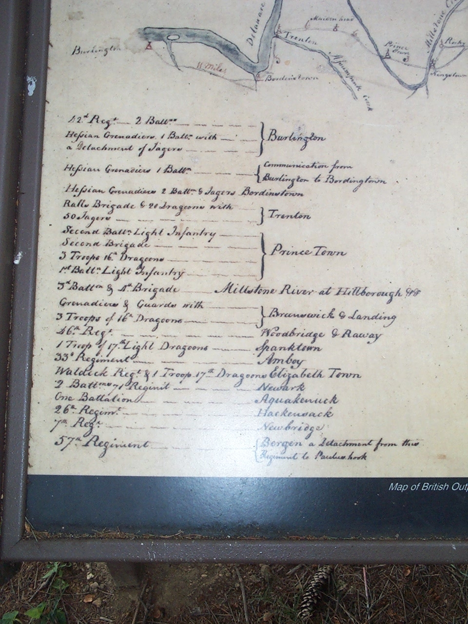
The British Outpost Map Legend | Additional Description: Map of British Outposts between Burlington and New Bridge, New Jersey, December 1776
Library of Congress, Geography and Map Division
Submitted: August 12, 2008, by Gary Nigh of Trenton, New Jersey.
Database Locator Identification Number: p31351
File Size: 0.351 Megabytes
To see the metadata that may be embedded in this photo, sign in and then return to this page.