Photograph as originally submitted to
this page in the Historical Marker Database
www.HMdb.org.
Click on photo to resize in browser. Scroll down to see metadata.
Photographer: Craig Swain
Taken: July 6, 2008
Caption:
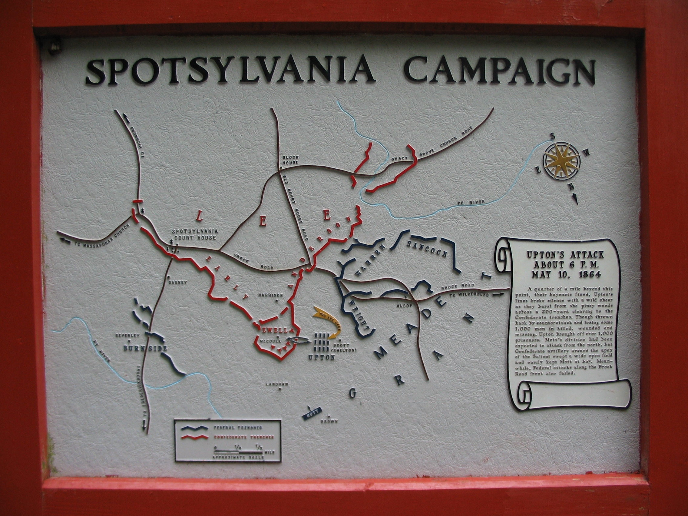
Spotsylvania Campaign Map | Additional Description:
Upton's Attack About 6 p.m. May 10, 1864A quarter of a mile beyond this point, their bayonets fixed, Upton's lines broke silence with a wild cheer as they burst from the piney woods across a 200-yard clearing to the Confederate trenches. Though thrown back by counterattack and losing some 1,000 men in killed, wounded and missing, Upton brought off over 1,000 prisoners. Mott's division had been expected to attack from the north, but Confederate artillery around the apex of the Salient swept a wide open field and easily kept Mott at bay. Meanwhile, Federal attacks along the Brock Road front also failed.Double click on the photo to see an enlarged view of the map.
Submitted: August 15, 2008, by Craig Swain of Leesburg, Virginia.
Database Locator Identification Number: p31811
File Size: 1.199 Megabytes
To see the metadata that may be embedded in this photo, sign in and then return to this page.