Photograph as originally submitted to
this page in the Historical Marker Database
www.HMdb.org.
Click on photo to resize in browser. Scroll down to see metadata.
Taken: Circa 1910
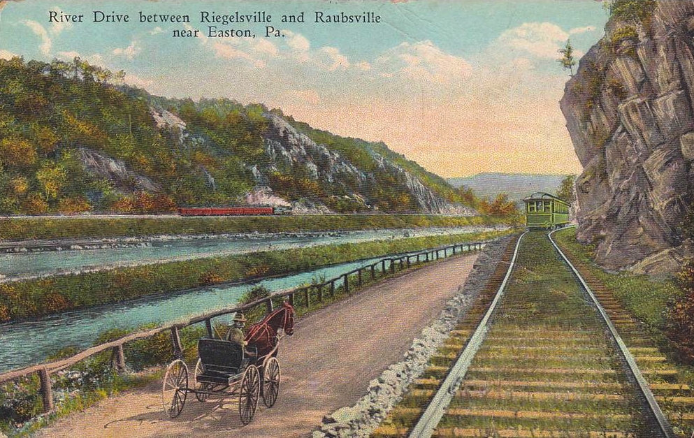
Caption:
River Drive between Riegelsville and Raubsville near Easton, Pa. | Additional Description: Although the makers of this postcard probably never thought of it this way, what is depicted here is a pre-automobile transportation corridor providing the right of way for five possible modes of transportation: the railroad, the Delaware River, the Delaware Canal, the towpath/road, and the trolley.
Submitted: July 27, 2015.
Database Locator Identification Number: p318313
File Size: 0.473 Megabytes
To see the metadata that may be embedded in this photo, sign in and then return to this page.