Photograph as originally submitted to
this page in the Historical Marker Database
www.HMdb.org.
Click on photo to resize in browser. Scroll down to see metadata.
Photographer: Craig Swain
Taken: July 6, 2008
Caption:
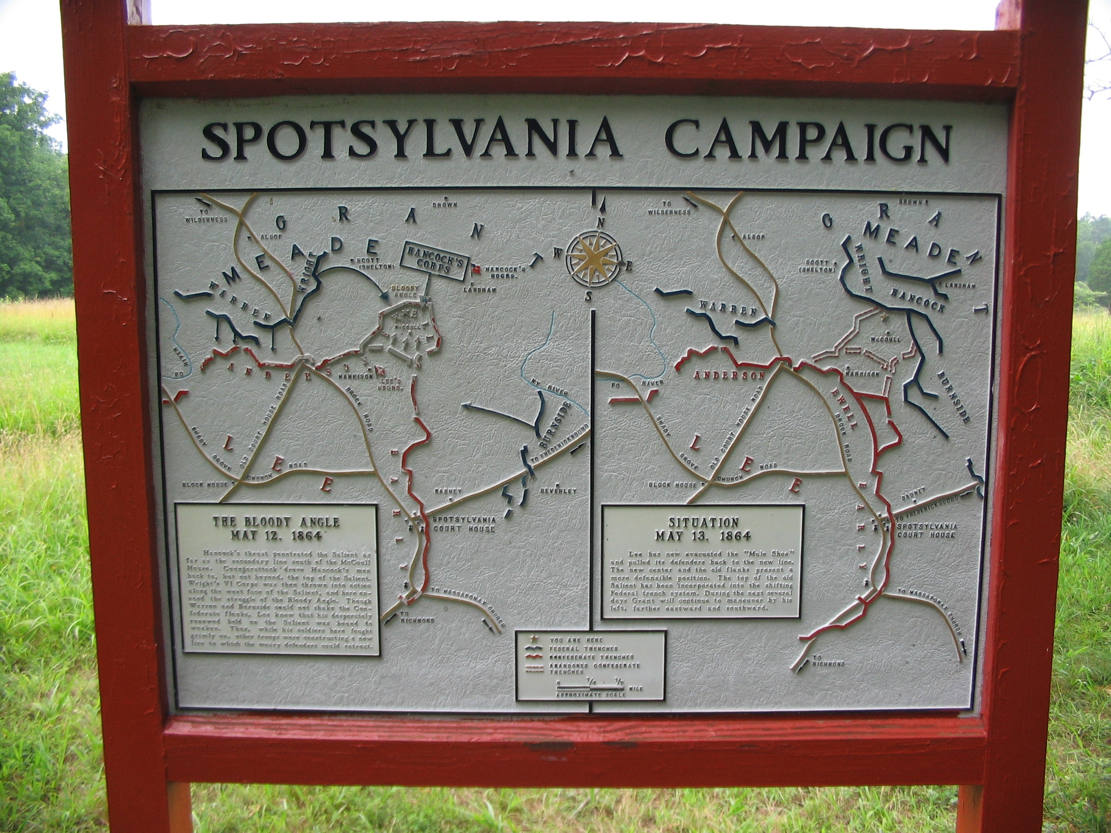
Campaign Map | Additional Description: Left side:
The Bloody Angle May 12, 1864Hancock's thrust penetrated the Salient as far as the secondary line south of the McCoull House. Counterattack drove Hancock's men back to, but not beyond, the top of the Salient. Wright's VI Corps was then thrown into the action along the west face of the Salient, and here ensued the struggle of the Bloody Angle. Though Warren and Burnside could not shake the Confederate flanks, Lee knew that his desperately renewed hold on the Salient was bound to weaken. Thus, while his soldiers here fought grimly on, other troops were constructing a new line to which the weary defenders could retreat.Right side:
Situation May 13, 1864Lee has now evacuated the "Mule Shoe" and pulled its defenders back to the new line. The new center and the old flanks present a more defensible position. The top of the old Salient has been incorporated into the shifting Federal trench system. During the next several days Grant will continue to maneuver by the left, farther eastward and southward.Double click on the photograph to view the map details.
Submitted: August 15, 2008, by Craig Swain of Leesburg, Virginia.
Database Locator Identification Number: p31845
File Size: 1.334 Megabytes
To see the metadata that may be embedded in this photo, sign in and then return to this page.