Photograph as originally submitted to
this page in the Historical Marker Database
www.HMdb.org.
Click on photo to resize in browser. Scroll down to see metadata.
Photographer: Craig Swain
Taken: July 6, 2008
Caption:
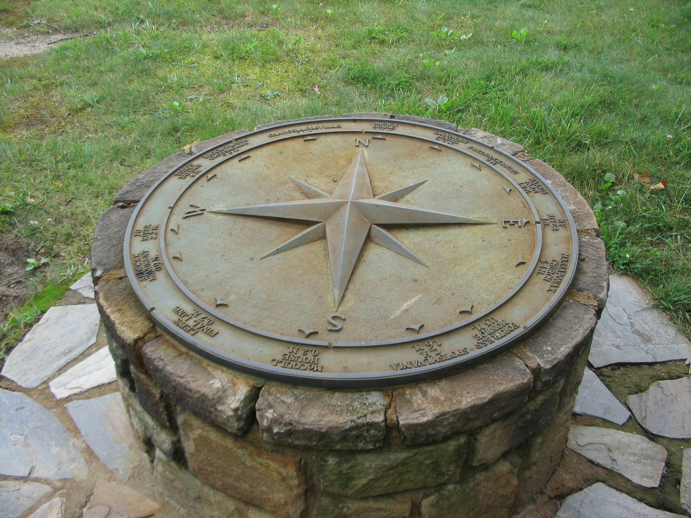
Compass | Additional Description: As at many locations on the Fredericksburg and Spotsylvania Battlefields, a compass points out the distances to different strategic points. From the north, clockwise - Brown House 0.8 m, Landram House 0.3 m, Fredericksburg 9 m, Harris Farm 1.9 m, Ny River 1 m,
Massaponax Church 5.4 m, Fortress Monroe 113 m, Spotsylvania C.H. 1.6 m, McCoull House 0.2 m,
Lee's Final Line 0.7 m, Sedgwick Monument 0.9 m,
Po River 2.2 m, Todd's Tavern 4 m, Brock-Plank Crossroads 7.9 m, and Chancellorsville 6.1 m
Submitted: August 18, 2008, by Craig Swain of Leesburg, Virginia.
Database Locator Identification Number: p32238
File Size: 1.491 Megabytes
To see the metadata that may be embedded in this photo, sign in and then return to this page.