Photograph as originally submitted to
this page in the Historical Marker Database
www.HMdb.org.
Click on photo to resize in browser. Scroll down to see metadata.
Photographer: Don Morfe
Taken: October 13, 2015
Caption:
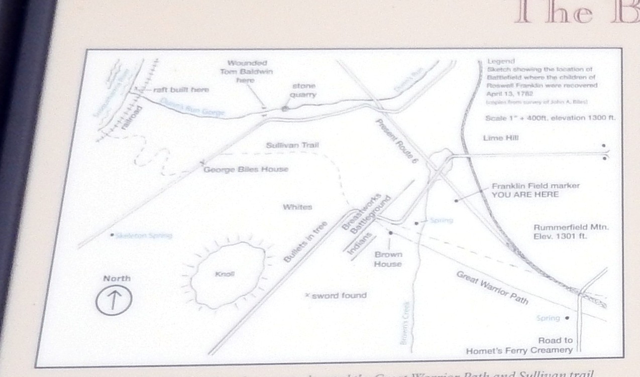
The map on The Battle of Lime Hill Marker | Additional Description: (Inscription below the map) John Biles had studied the first hand accounts, located the Great Warrior Path and Sullivan trail, walked the field with historian Reverend David Craft and one of the rescuers, Sergeant Baldwin’s grandson and was able to pinpoint the battlefield. With out this map, we could probably never have learned exactly where the battle occurred.
Submitted: November 11, 2015, by Don Morfe of Baltimore, Maryland.
Database Locator Identification Number: p337818
File Size: 0.163 Megabytes
To see the metadata that may be embedded in this photo, sign in and then return to this page.