Photograph as originally submitted to
this page in the Historical Marker Database
www.HMdb.org.
Click on photo to resize in browser. Scroll down to see metadata.
Photographer: Bill Coughlin
Taken: August 12, 2008
Caption:
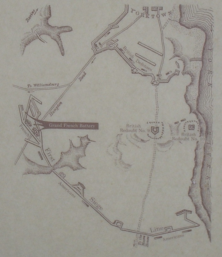
Yorktown Fortifications Map | Additional Description: This map showing the fortifications at Yorktown in 1781 is on another marker at this site. The location of the Grand French Battery is indicated on the map.
Submitted: September 1, 2008, by Bill Coughlin of Woodland Park, New Jersey.
Database Locator Identification Number: p33826
File Size: 0.311 Megabytes
To see the metadata that may be embedded in this photo, sign in and then return to this page.