Photograph as originally submitted to
this page in the Historical Marker Database
www.HMdb.org.
Click on photo to resize in browser. Scroll down to see metadata.
Photographer: Alan M. Perrie
Taken: December 18, 2015
Caption:
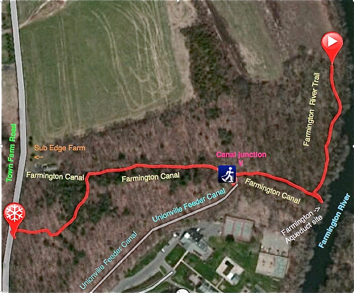
Satellite map of the yellow blazed Farmington Canal and River Trail. | Submitted: January 10, 2016, by Alan M. Perrie of Unionville, Connecticut.
Database Locator Identification Number: p343800
File Size: 0.769 Megabytes
To see the metadata that may be embedded in this photo, sign in and then return to this page.