Photograph as originally submitted to
this page in the Historical Marker Database
www.HMdb.org.
Click on photo to resize in browser. Scroll down to see metadata.
Photographer: Alan M. Perrie
Taken: January 11, 2016
Caption:
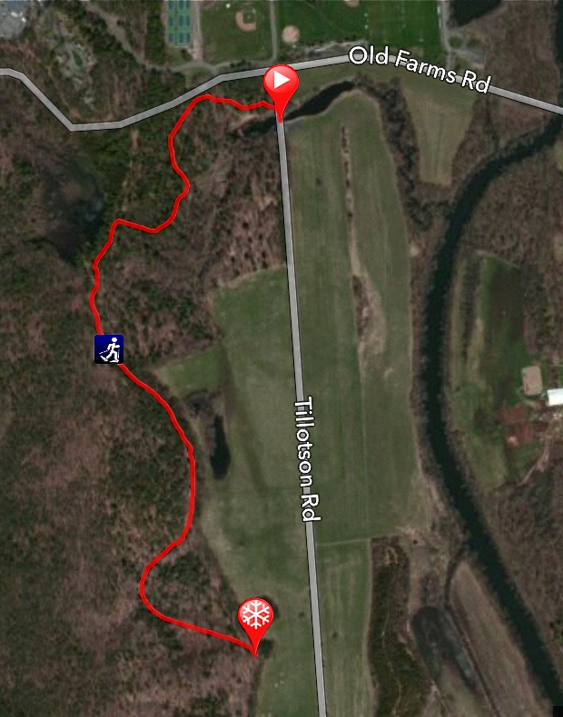
Satellite map of Avon’s Farmington Canal Trail | Additional Description: Park on the east side of Tillotson Road just before the stop sign at Old Farms Road. The yellow blazed trail starts on the west side, north of the bridge. At 0.4 miles, after going over the towpath, take a left into the almost 200 year old Farmington Canal. Take care crossing the Thomson Brook Culvert, since it is starting to show its age. Walk south for 0.8 miles in the middle of the Farmington Canal. Experience the size of the canal and note the very level towpath on your left (east). To the right is a large deposit of glacial till which was used to build the towpath. If you see the silo for the Sub Edge Farm, you need to turn around. The future plan is to continue the trail around Sub Edge Farm to join the Farmington Canal Trail in Farmington.
Submitted: February 2, 2016, by Alan M. Perrie of Unionville, Connecticut.
Database Locator Identification Number: p344787
File Size: 0.720 Megabytes
To see the metadata that may be embedded in this photo, sign in and then return to this page.