Photograph as originally submitted to
this page in the Historical Marker Database
www.HMdb.org.
Click on photo to resize in browser. Scroll down to see metadata.
Photographer: Barry Swackhamer
Taken: December 28, 2015
Caption:
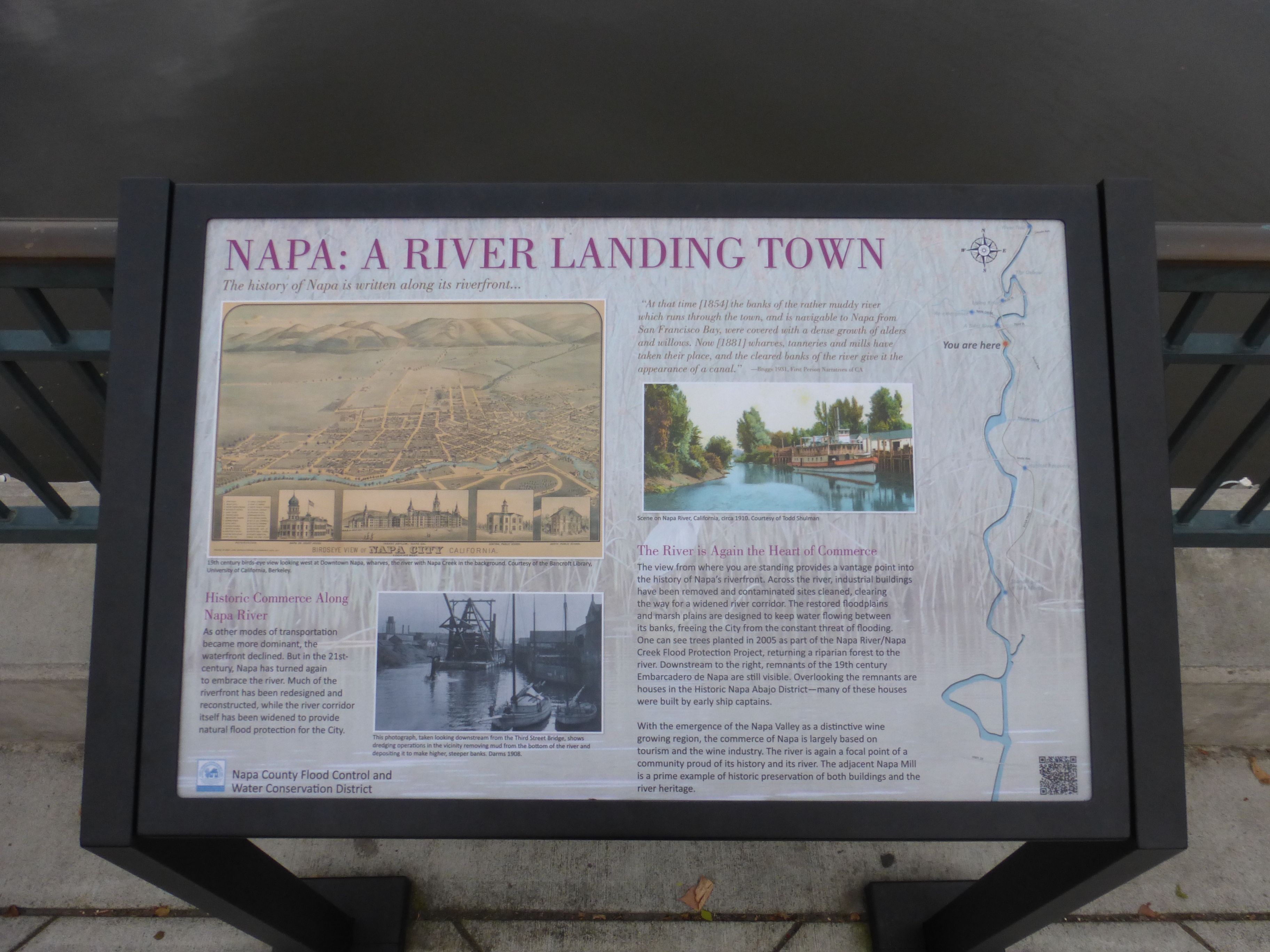
Napa: A River Landing Town Marker | Additional Description: Captions: (upper left) 19th century birds-eye view looking west at Downtown Napa, wharves, the river with Napa Creek in the background.; (bottom left) This photograph, taken looking downstream from the Third Street Bridge, shows dredging operations in the vicinity removing mud from the bottom of the river and depositing it to make higher, steeper banks. Circa 1908.; (upper right)
"At that time (1854) the banks of the rather muddy river which runs through the town and is navigable to Napa from San Francisco Bay, were covered with a dense growth of alders and willows. Now (1881) wharves, tanneries and mills have taken their place, and the cleared banks of the river give it the appearance of a canal." - Briggs, 1931, First Person Narratives of CA; Scene on Napa River, circa 1910.
Submitted: February 7, 2016, by Barry Swackhamer of Brentwood, California.
Database Locator Identification Number: p344919
File Size: 4.257 Megabytes
To see the metadata that may be embedded in this photo, sign in and then return to this page.