Photograph as originally submitted to
this page in the Historical Marker Database
www.HMdb.org.
Click on photo to resize in browser. Scroll down to see metadata.
Photographer: Don Morfe
Taken: September 14, 2007
Caption:
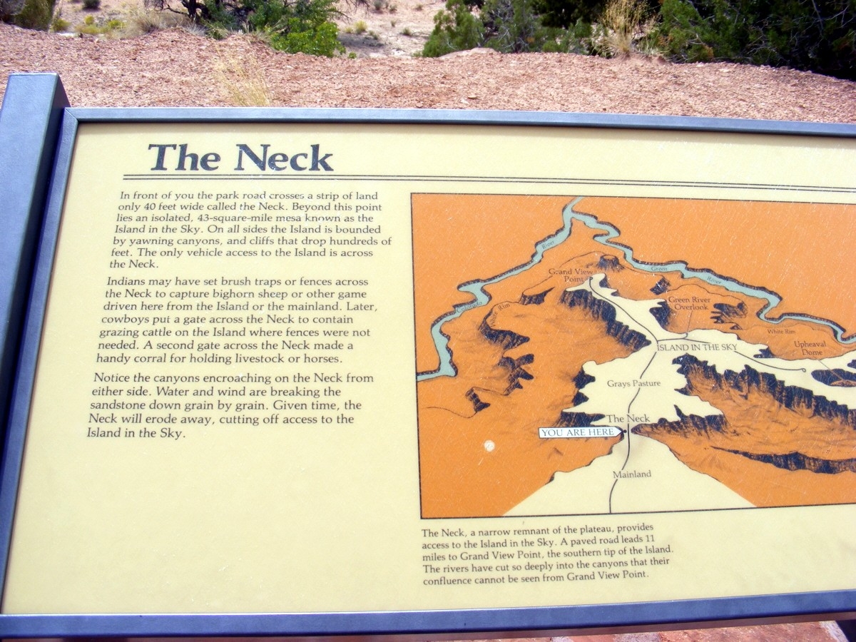
The Neck Marker | Additional Description:
(Inscription under the image on the right)
The Neck, a narrow remnant of the plateau, provides access to the Island in the Sky. A paved road leads 11 miles to Grand View Point, the southern tip of the Island. The rivers have cut so deeply into the canyons that their confluence cannot be seen from Grand View Point.
Submitted: February 11, 2016, by Don Morfe of Baltimore, Maryland.
Database Locator Identification Number: p345111
File Size: 0.338 Megabytes
To see the metadata that may be embedded in this photo, sign in and then return to this page.