Photograph as originally submitted to
this page in the Historical Marker Database
www.HMdb.org.
Click on photo to resize in browser. Scroll down to see metadata.
Photographer: Rev. Ronald Irick
Taken: April 2, 2016
Caption:
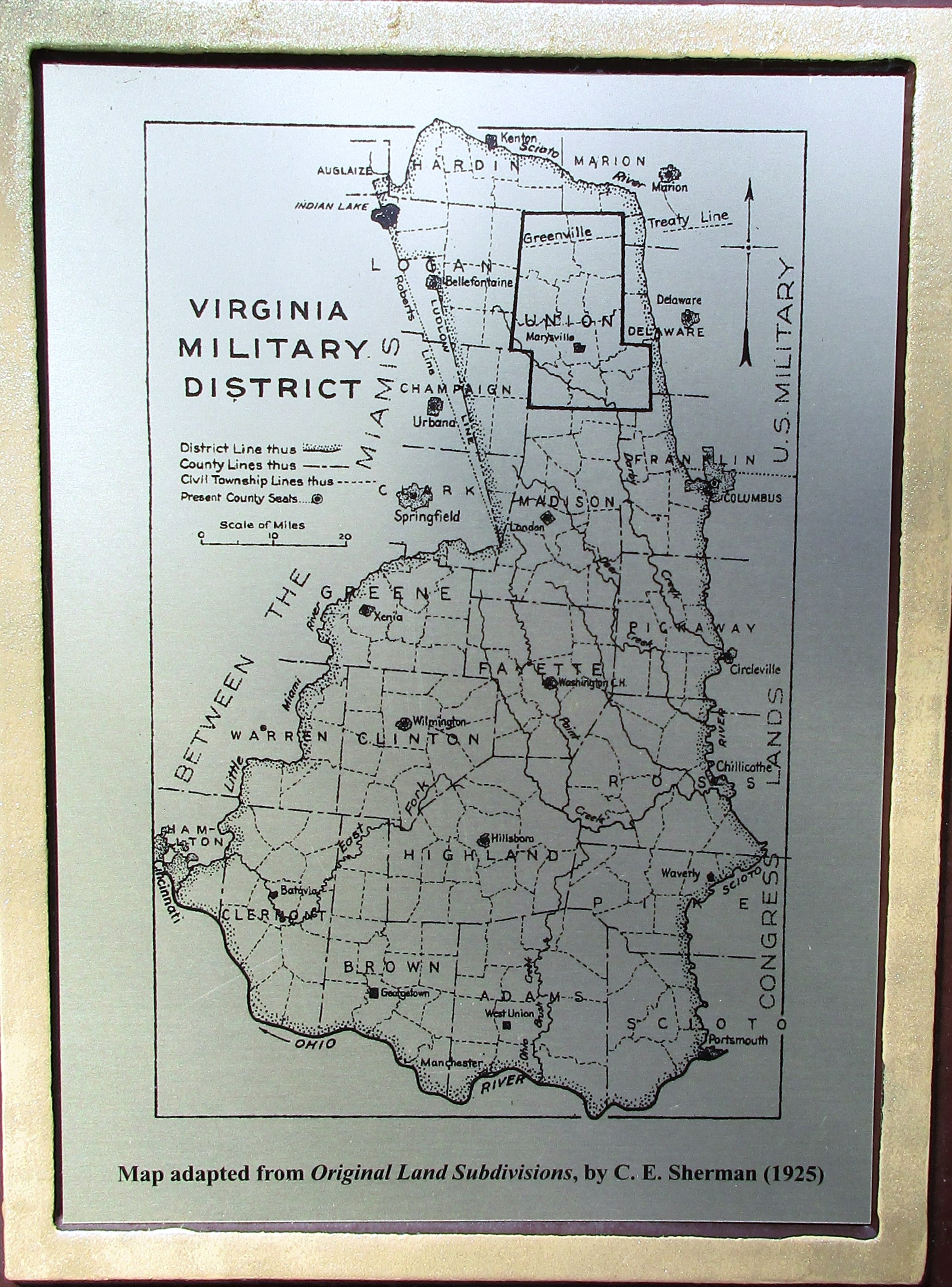
Virginia Military District Marker | Additional Description: C. E. Sherman's map of the VMS
I don't have a web-link, but this is the reference info for Sherman's work:
Original Ohio land subdivisions, by C. E. Sherman. 235 p., illustrated, 1925. Reprinted 1972, 1976, 1982, 1991, 2005.
Submitted: April 2, 2016, by Rev. Ronald Irick of West Liberty, Ohio.
Database Locator Identification Number: p348443
File Size: 1.431 Megabytes
To see the metadata that may be embedded in this photo, sign in and then return to this page.