Photograph as originally submitted to
this page in the Historical Marker Database
www.HMdb.org.
Click on photo to resize in browser. Scroll down to see metadata.
Photographer: Barry Swackhamer
Taken: April 1, 2016
Caption:
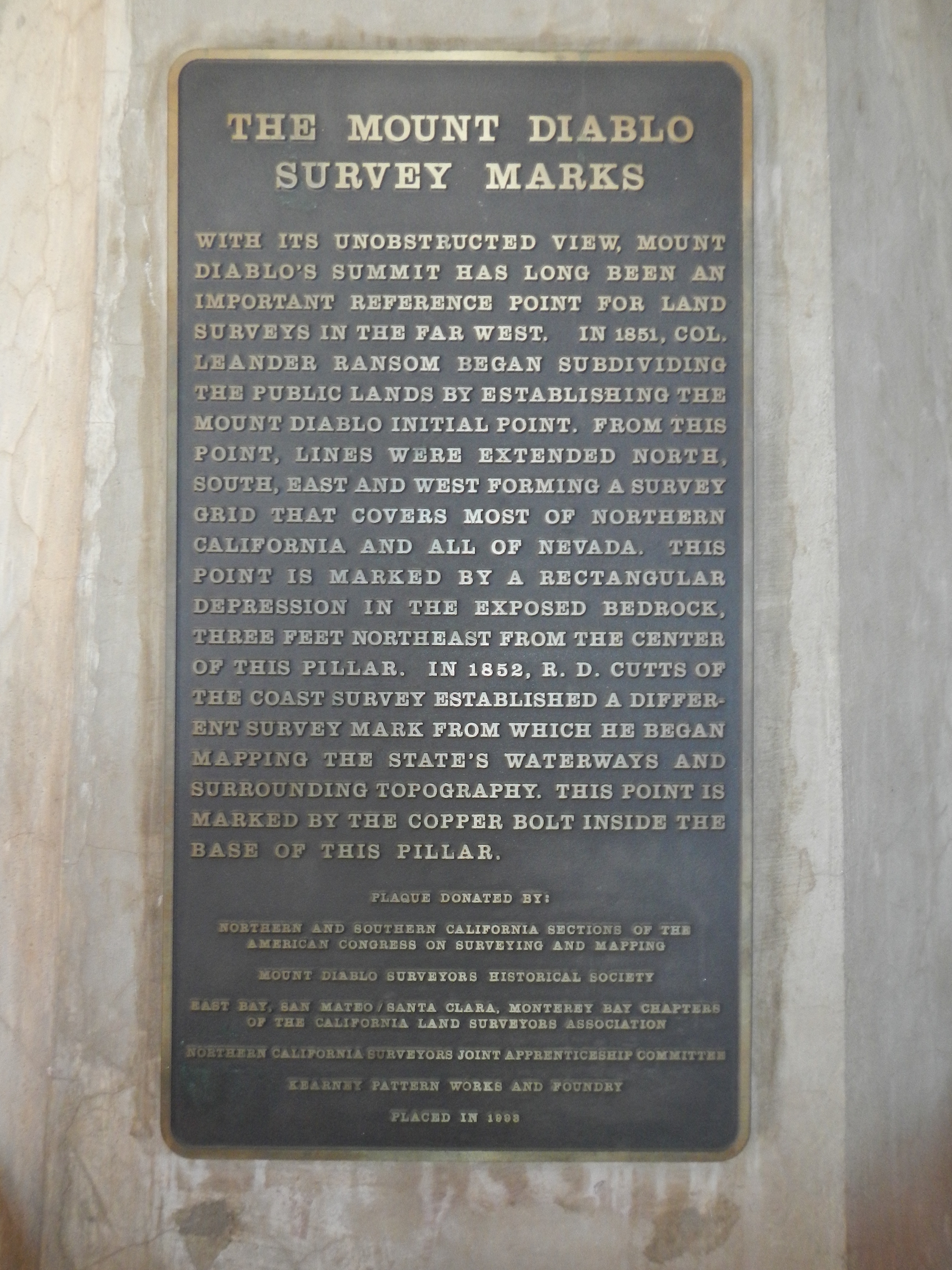
The Mount Diablo Survey Marks | Additional Description: With its unobstructed view, Mount Diablo's summit has long been an important reference point for land surveys in the far west. In 1851, Col. Leander Ransom began subdividing the public lands by establishing the Mount Diablo Initial Point. From this point, lines were extended north, south east and west forming a survey grid that covers most of Northern California and all of Nevada. This point is marked by an rectangular depression in the exposed bedrock, three feet north east from the center of this pillar. In 1852, R.D. Cutts of the Coast Survey established a different survey mark from which he began mapping the State's waterways and surrounding topography. This point is marked by a copper bolt inside the base of this pillar.
Plaque Donated By:
Northern and Southern California Sections of the American Congress on Surveying and Mapping
Mount Diablo Surveyors Historical Society
East Bay, San Mateo/Santa Clara, Monterey Bay Chapters of the California Land Surveyors Association
Northern California Surveyors Joint Apprenticeship Committee
Kearney Pattern Works and Foundry
Placed in 1993 Submitted: April 5, 2016, by Barry Swackhamer of Brentwood, California.
Database Locator Identification Number: p348698
File Size: 3.391 Megabytes
To see the metadata that may be embedded in this photo, sign in and then return to this page.