Photograph as originally submitted to
this page in the Historical Marker Database
www.HMdb.org.
Click on photo to resize in browser. Scroll down to see metadata.
Photographer: Brian Scott
Taken: September 5, 2008
Caption:
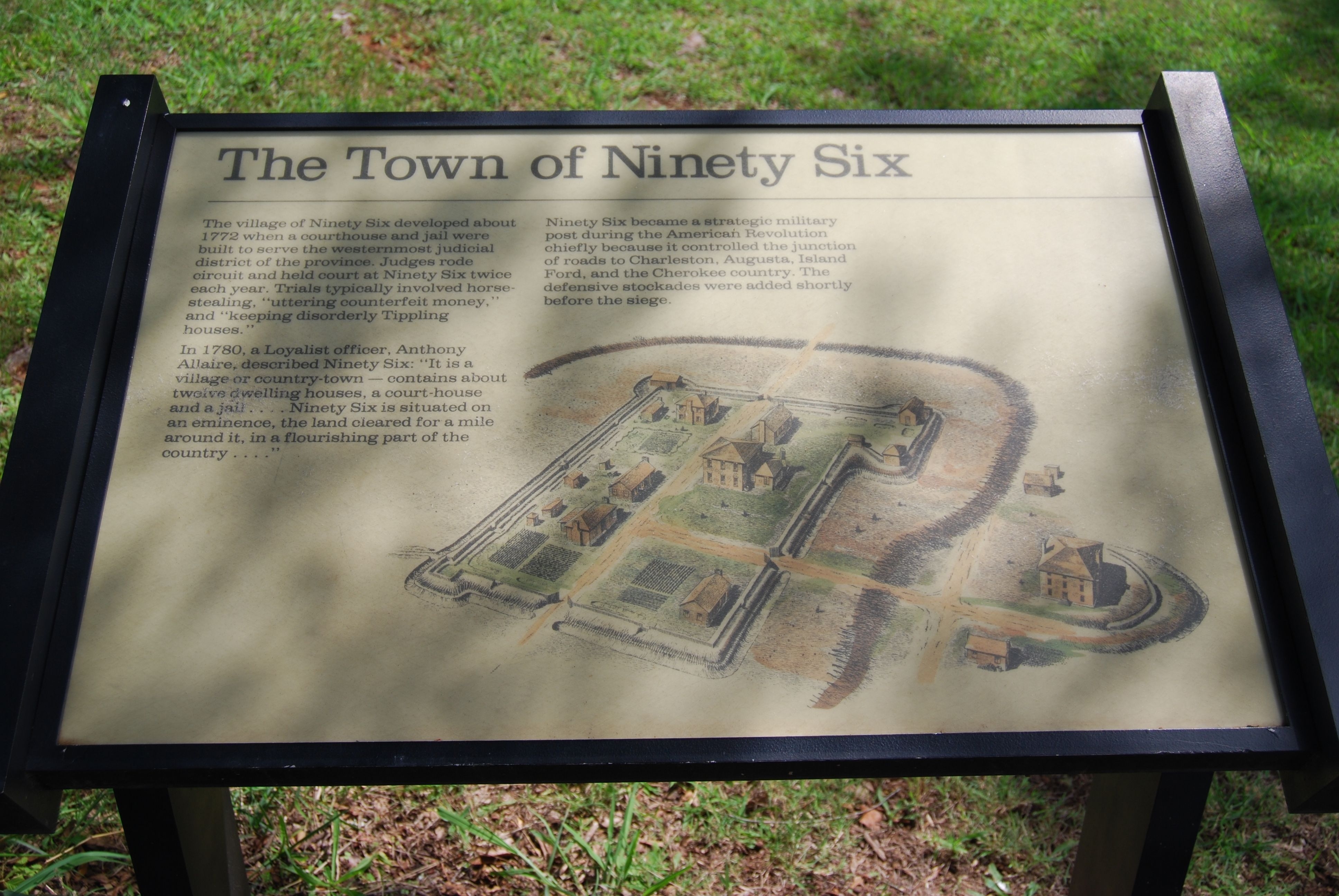
Original The Town of Ninety Six Marker | Additional Description: The village of Ninety Six developed about 1772 when a courthouse and jail were built to serve the westernmost judicial district of the province. Judges rode circuit and held court at Ninety Six twice each year. Trials typically involved horse-stealing, "uttering counterfeit money," and "keeping disorderly Tippling houses."
In 1780, a Loyalist officer, Anthony Allaire, described Ninety Six: "It is a village or country town -- contains about twelve dwelling houses, a court-house and a jail...Ninety Six is situated on an eminence, the land cleared for a mile around it, in a flourishing part of the country..."
Ninety Six became a strategic military post during the American Revolution chiefly because it controlled the junction of roads to Charleston, Augusta, Island Ford, and the Cherokee country. The defensive stockades were added shortly before the siege.
Submitted: September 9, 2008, by Brian Scott of Anderson, South Carolina.
Database Locator Identification Number: p34980
File Size: 2.465 Megabytes
To see the metadata that may be embedded in this photo, sign in and then return to this page.