Photograph as originally submitted to
this page in the Historical Marker Database
www.HMdb.org.
Click on photo to resize in browser. Scroll down to see metadata.
Photographer: Public Domain
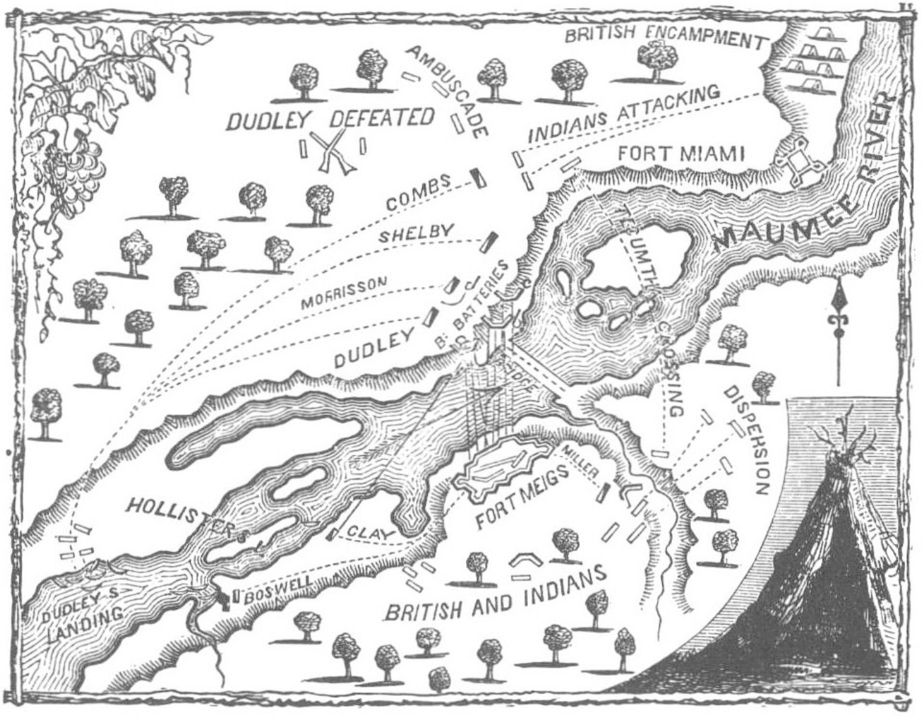
Caption:
Clay's Landing | Additional Description: View of a map of the First Siege of Fort Meigs, showing the site of General Clay's landing on May 5, 1813.
Submitted: April 20, 2016, by Dale K. Benington of Toledo, Ohio.
Database Locator Identification Number: p350220
File Size: 0.438 Megabytes
To see the metadata that may be embedded in this photo, sign in and then return to this page.