Photograph as originally submitted to
this page in the Historical Marker Database
www.HMdb.org.
Click on photo to resize in browser. Scroll down to see metadata.
Photographer: Shane Oliver
Taken: March 28, 2016
Caption:
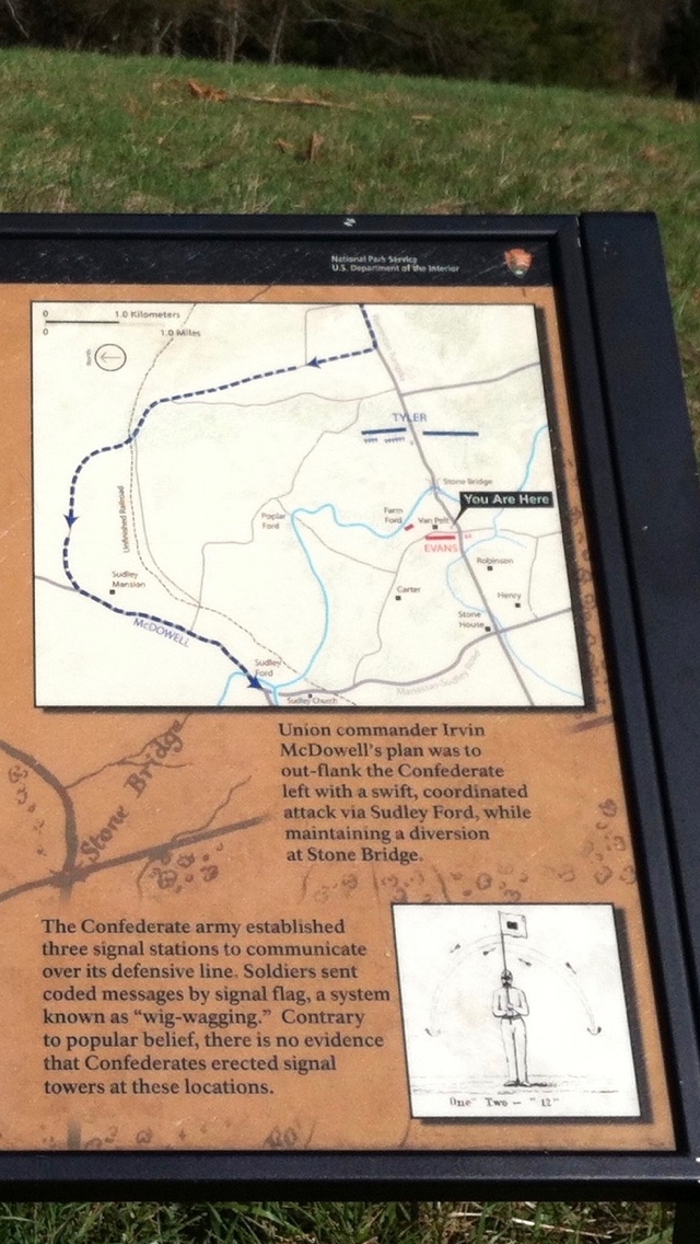
Close-up View of Map & Sketch on the "Opening Shots" Marker | Additional Description: Map Caption:
"Union commander Irvin McDowell's plan was to out-flank the Confederate left with a swift, coordinated attack via Sudley Ford, while maintaining a diversion at Stone Bridge.
Sketch Caption:
"The Confederate army established three signal stations to communicate over its defensive line. Soldiers sent coded messages via signal flag, a system known as "wig-wagging." Contrary to popular belief, there is no evidence that Confederates erected signal towers at these locations.
Submitted: May 13, 2016, by Shane Oliver of Richmond, Virginia.
Database Locator Identification Number: p352080
File Size: 1.350 Megabytes
To see the metadata that may be embedded in this photo, sign in and then return to this page.