Photograph as originally submitted to
this page in the Historical Marker Database
www.HMdb.org.
Click on photo to resize in browser. Scroll down to see metadata.
Photographer: David Graff
Taken: May 24, 2016
Caption:
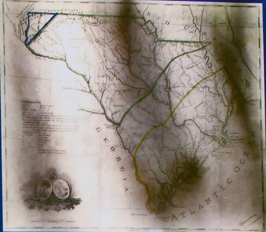
Backcountry Map | Additional Description: South Carolina's "Upper Country" region is outlined in green on this 1802 map. During the Revolutionary War, this area was known as the "Carolina Backcountry." —
Map courtesy of the South Caroliniana LibrarySubmitted: May 31, 2016, by David Graff of Halifax, Nova Scotia.
Database Locator Identification Number: p353503
File Size: 0.097 Megabytes
To see the metadata that may be embedded in this photo, sign in and then return to this page.