Photograph as originally submitted to
this page in the Historical Marker Database
www.HMdb.org.
Click on photo to resize in browser. Scroll down to see metadata.
Photographer: Dean Moss McCracken
Taken: May 27, 2016
Caption:
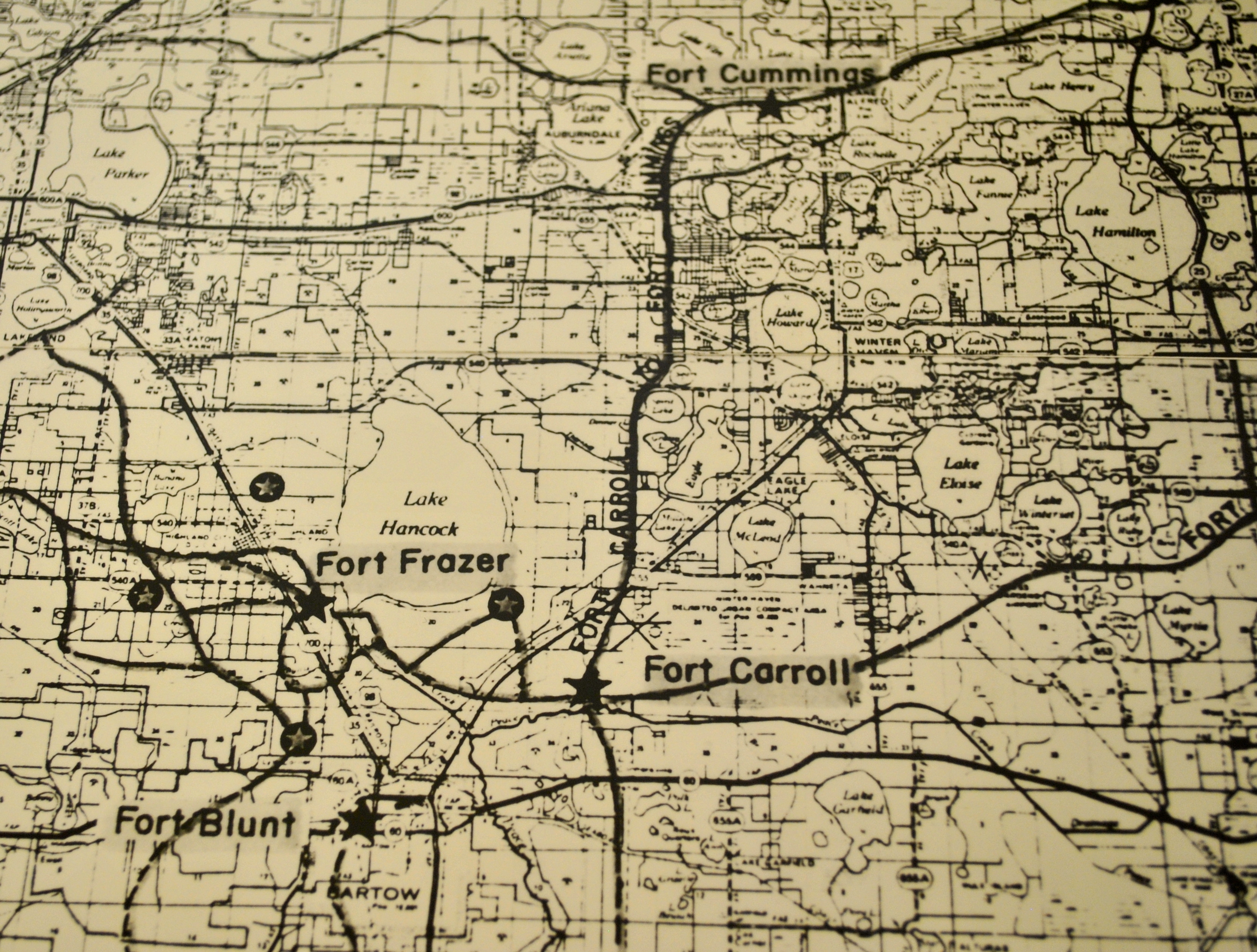
Map of Ft. Carroll | Additional Description: 1971 Florida Dept. of Transportation highway map showing Ft. Carroll and the road to Ft. Cummings. Map courtesy: Polk County Historical and Genealogical Library.
Submitted: June 15, 2016, by Dean Moss McCracken of Lakeland, Florida.
Database Locator Identification Number: p354306
File Size: 3.351 Megabytes
To see the metadata that may be embedded in this photo, sign in and then return to this page.