Photograph as originally submitted to
this page in the Historical Marker Database
www.HMdb.org.
Click on photo to resize in browser. Scroll down to see metadata.
Photographer: Barry Swackhamer
Taken: May 29, 2016
Caption:
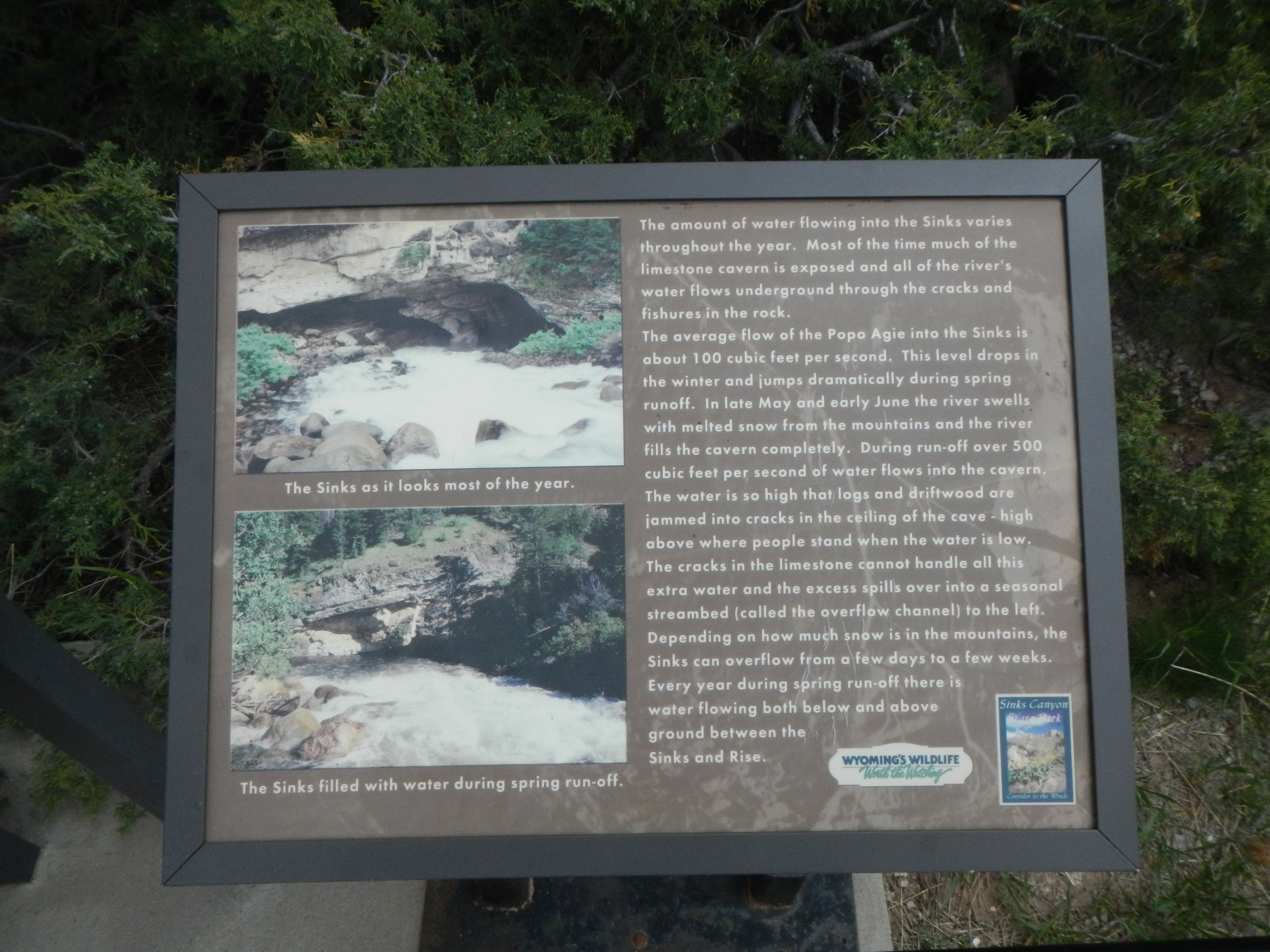
The Sinks, second marker | Additional Description: The amount of water flowing into the Sinks varies throughout the year. Most of the time much of the limestone cavern is exposed and all of the river’s water flows underground through the cracks and fishures (sic) in the rock.
The average flow of the Popo Agie into the Sinks is about 100 cubic feet per second. This level drops in the winter and jumps dramatically during spring runoff. In late May and early June the river swells with melted snow from the mountains and the river fills the cavern completely. During run-off over 500 cubic feet per second of water flows into the cavern. The water is so high that logs and driftwood ear jammed into cracks in the ceiling of the cave – high above where people stand when the water is low. The cracks in the limestone cannot handle all this extra water and the excess spills over into a seasonal streambed (called the overflow channel) to the left. Depending on how much snow is in the mountains, the Sinks can overflow from a few days to a few weeks. Every year during spring run-off there is water flowing both below and above ground between the Sinks and Rise.
Captions: (top left) The Sinks as it looks most of the year.; (bottom left) The Sinks filled with water during spring run-off.
Submitted: July 14, 2016, by Barry Swackhamer of Brentwood, California.
Database Locator Identification Number: p356241
File Size: 3.572 Megabytes
To see the metadata that may be embedded in this photo, sign in and then return to this page.