Photograph as originally submitted to
this page in the Historical Marker Database
www.HMdb.org.
Click on photo to resize in browser. Scroll down to see metadata.
Caption:
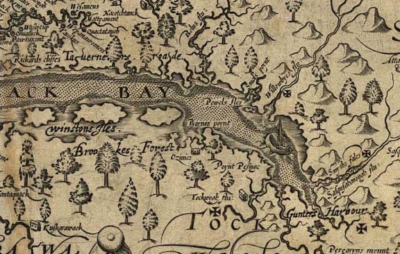
Section of an ancient map by John Smith | Additional Description: Explorer Captain John Smith drew a map of Virginia, and the Chesapeake Bay, in 1612. This is a piece of that map showing Smyth's Falls (mentioned on this marker) It is the X on the right margin at center.
Submitted: August 4, 2016, by Keith S Smith of West Chester, Pennsylvania.
Database Locator Identification Number: p358384
File Size: 0.130 Megabytes
To see the metadata that may be embedded in this photo, sign in and then return to this page.