Photograph as originally submitted to
this page in the Historical Marker Database
www.HMdb.org.
Click on photo to resize in browser. Scroll down to see metadata.
Photographer: Bill Coughlin
Taken: July 12, 2008
Caption:
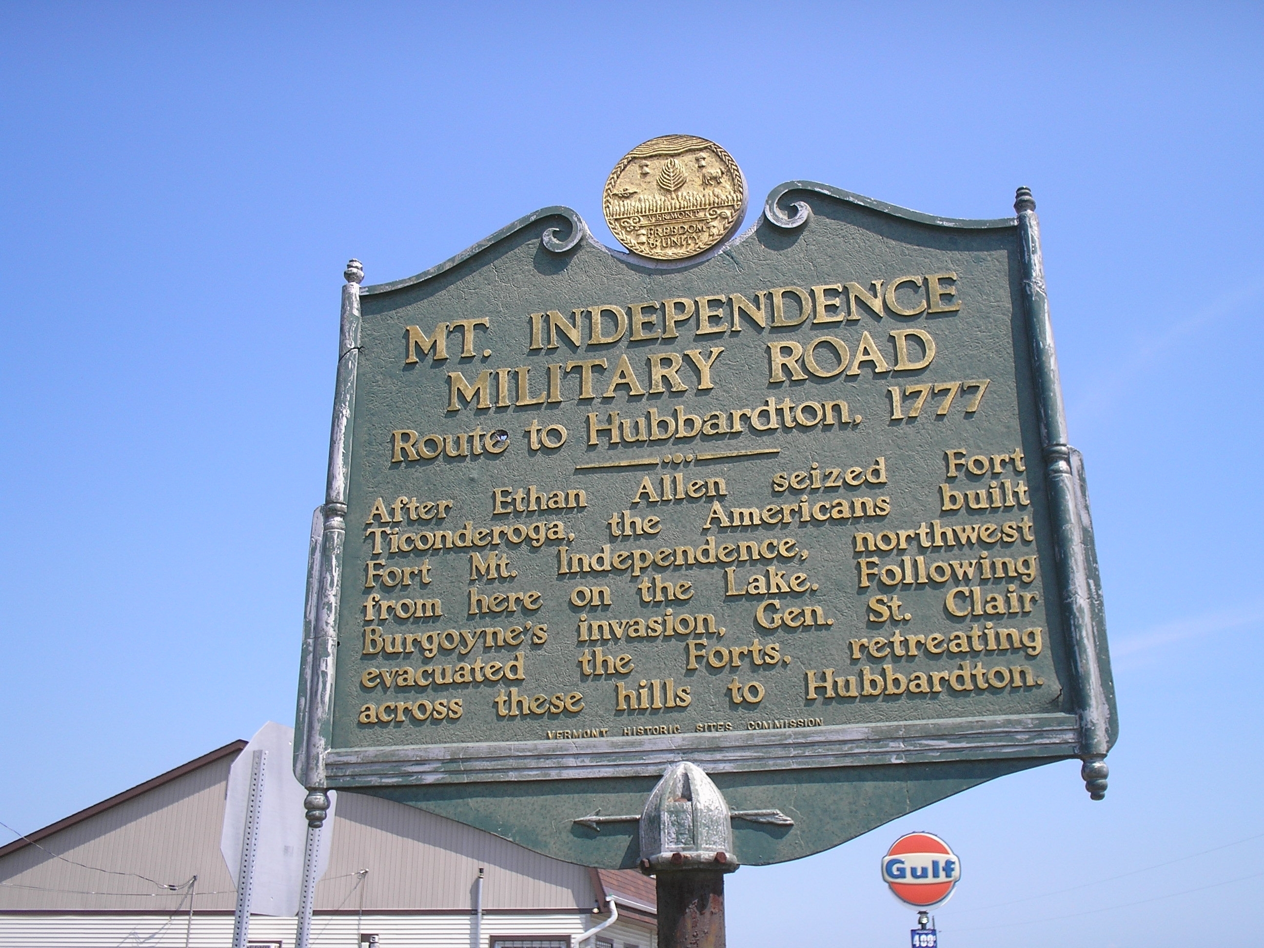
Original 1949 Mt. Independence Military Road Marker | Additional Description: After Ethan Allen seized Fort Ticonderoga, the Americans built Fort Mt. Independence, northwest from here on the Lake. Following Burgoyne’s invasion, Gen. St. Clair evacuated the Forts, retreating across these hills to Hubbardton.
Submitted: July 16, 2008, by Bill Coughlin of Woodland Park, New Jersey.
Database Locator Identification Number: p361128
File Size: 0.953 Megabytes
To see the metadata that may be embedded in this photo, sign in and then return to this page.